|
 Trace fossils are the preserved traces of ancient organisms, and include their burrows, imprints, tracks, and trails, but not their bones or shells. The study of trace fossils is known as ichnology, and it is very important when dealing with invertebrate organisms, as they have no hard parts to leave behind and preserve as fossils. Trace fossils are the preserved traces of ancient organisms, and include their burrows, imprints, tracks, and trails, but not their bones or shells. The study of trace fossils is known as ichnology, and it is very important when dealing with invertebrate organisms, as they have no hard parts to leave behind and preserve as fossils.
Ichnology can be a difficult subject to learn about, as the terminology is quite complex, and most publications seem to focus on associations of trace fossils, rather than on providing clues to properly identifying the traces. If you want to learn more about ichnology, the button below leads to the "trace fossil" article on Wikipedia, which is a good place to start.
Below are links to additional internet resources. Some of these have lots of photos, which can be a great help in making an identification.
Ichnogenera Photos by Chuck D. Howell
Trace Fossil Database by Anthony Martin, Emory University
University of Kansas Ichnology by Stephen Hasiotis
|
|
Glossary of Terms
History of Ichnology
Trace Fossil Comparisons (spreadsheet)
|
The database below has links that lead to descriptions of some of the more common trace fossils of the San Joaquin Valley, and adjacent areas in California. Also included are a few trace fossils that you might encounter on a raft trip down the Grand Canyon. Trace fossils from cores collected in oil fields of the San Jaoquin Valley are shown on the right-hand side of the descriptions.
Examples of Trace Fossils
The cast of a horizontal burrow |
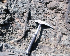
A complex burrow excavated in 3D
using an air gun in soft sediment
(Photo by Dr. Peter Pervesler) |
Raindrop Imprints - Not the trace of an
organism, but a trace nonetheless.
They are also known as "pseudo-fossils" |
Dinosaur tracks are a type of trace.
This one, now called Eubrontes,
was first described in 1836 |
Biologic Traces

 |
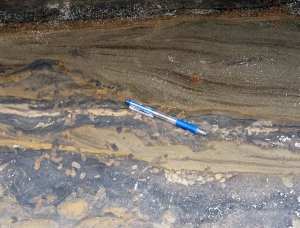
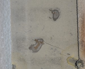
 Adhesive Meniscate Burrows (AMBs) - Vertical to inclined to horizontal, elliptical burrow chambers with mud-lined walls, and menisci filling the chambers. The burrows may be made of isolated chambers (see the core example on the right), but the chambers more often are arranged one after another to make linear, wandering traces up to several inches long. Because the burrow fill adheres to the surrounding matrix such that the burrows are found only in cross-section and not as casts or molds, they are described as "adhesive".
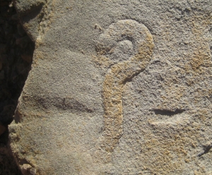
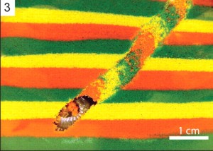
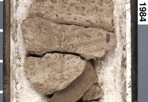
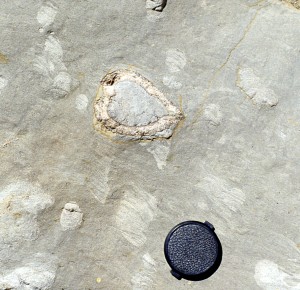
This trace has the "official" scientific (ichnogenera) name of Naktodemasis, and it is found in non-marine rocks, such as paleosoils. Sometimes it is associated with rhizoliths (tree roots), which leads some to interpret it as being made by beetles and/or insect larvae that tunneled through wet soil in search of roots to eat. The outcrop example on the upper left shows several of these burrows on top of a lacustrine sandstone from the Piru Gorge Sandstone (Miocene Ridge Route Formation) that crops out along Old Templin Highway in the California Transverse Ranges (south margin of the San Joaquin Valley). A simulation model on the lower left shows a burrow made through colored sand layers by a Cicada nymph (from Smith & Hasiotis, 2008). On the right is a burrow in a core from the Pleistocene Tulare Formation in the EXF 376T well at Midway-Sunset oil field (San Joaquin Valley).
More Photographs
|
|
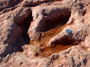
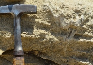
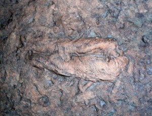
Animal Tracks (Ichnites) - Shown on the left is a trackway in the Coconino Sandstone (middle Permian) of a small reptile, basically a dinosaur, that is thought to have been scampering up a sand dune more than 250 million years ago. Note how sand appears to mound up at the heal of each track, indicating that the animal was moving up a slope. Chelichnus (Laoporus) is the name generally assigned to this particular trace, which is located at an outcrop that is a popular stop on many of the raft trips that float down the Grand Canyon. This particular outcrop has some notoreity, as it is often featured in debates between creationists arguing for a young earth, and geologists arguing that the earth is old. Dinosaur tracks are also important in the history of ichnology, as they represent the first trace fossils to be recognized by geologists. Besides dinosaur tracks, there are many other trace fossils that you might encounter in the Grand Canyon, such as trilobite tracks.
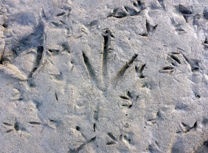
The photo below and left shows modern bird tracks on the receding shoreface of a small pond in Rockville Hills Park, Solano County. These tracks are modern examples of Ichnites traces. Birds of course are not dinosaurs, but we do believe that they descend from dinosaurs. Although no dinosaur tracks have ever been in the San Joaquin Valley that we are aware of, the tracks of various ancient mammals are found in some of the non-marine formations of the valley. The best known of these are camel tracks, which have the trace fossil name of Lamaichnum. The "Mammal Tracks" button below leads to more information on this particular trace. There is also a link with some additional information on dinosaur tracks.
|
 |
Ancorichnus - Vertical to inclined burrows with a burrow lining, and chevron-shaped backfilling menisci within the burrow. The burrows are found in non-marine settings, and are thought to be made by insects, particularly beetle larvae. The outcrop example on the left is from the uppermost Miocene Fisher Springs Sandstone member of the Ridge Route Formation exposed on Templin Highway in the California Transverse Ranges (south margin of the San Joaquin Valley.
|

 |
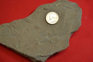
 Asterosoma - Bulbous to elliptical burrow chambers that are arranged along a central axial tube, somewhat like seed pods attached to a vine. The burrow chambers contain a radial backfill, called menisci, that form as the organism presses material into the burrow walls, yet tries to maintain an open burrow chamber of constant diameter. Thus, concentric patterns are created, with outer menisci getting thinner as inner menisci are pressed against them. When viewed in cross-section Asterosoma is typically spherical to lens-shaped with concentric rings around a central tube. When viewed from above some varieties exhibit bulbous tubes radiating out from a central axis, like the spokes of a wheel, whereas other varieties have iregular burrow chambers strung out along a meandering axial tube. Some traces identified as Asterosoma may actually be redeposited Rosselia.
Asterosoma burrows are probably a combination of dwelling and feeding traces made by burrowing shrimp or other arthropods. This trace is most often found in fine-grained, shallow-marine sandstones, but it is found in lagoonal and turbidite sediments as well. The outcrop example on the far left is from the Eocene Point of Rocks Formation exposed at Salt Creek Creek in the Temblor Range on the west margin of the San Joaquin Valley. Note the radial symmetry that resembles the spokes on a wheel. The diatomite hand sample in the inset photo on the immediate left shows an Asterosoma in cross section. It is from the Antelope Shale exposed at Chico-Martinez Creek, just a couple of miles from the Salt Creek outcrop example. The core photo on the right shows an Asterosoma burrow with views in both normal color (left view) and enhanced color (right view). The core is from the Brooks Sandstone (Pliocene Sisquoc Formation) in the Victory G3 well at East Cat Canyon oil field (Santa Maria Basin).
More Photographs
|
 |
 Bergaueria - Upside-down, protruding mounds in 3D that have smooth walls. The traces are spherical to elliptical in cross-section with rounded bases, sometimes with a dimple at the apex of the base. Although the fill is generally structureless, indicating a passive infill origin, the burrow walls sometimes display a lining. These burrows are thought to be the resting traces of sea anenomes. The outcrop example on the far left is from the Middle Miocene Buttonbed Sandstone Member of the basal Monterey Formation exposed at Buttonbed Hill on Twisselman Range (West Side San Joaquin Valley). A closeup view on the immediate right shows on the two trace towards the back of the cave, a wall lining on the left-hand trace, and a dimple at the apex of the base on the right-hand one.
|
 |
Bivalve Casts - When bivalves, such as clams, die in growth position, both the upper and lower valves of the animal may be initially preserved. However, as the soft body parts of the animal within the shell decays and rots away, mud can infiltrate into the resulting void to create a cast. If the shell itself then dissolves away, only a mudstone cast of the bivalve shell remains. Because clams have shells made of high-magnesium calcite, which is much more unstable than the low-magnesium calcite found in oyster and gastropod shells, the potential for clam shells to dissolve away and leave behind only a cast is fairly high.
The outcrop example on the left shows several bivalve casts in a bed of the Middle Eocene Matilija Formation exposed at Sespe Canyon in the California Transverse Ranges, which are located on the south margin of the San Joaquin Basin. Below it on the left is a bivalve cast in a core of the Pliocene Etchegoin Formation from the TWO 2536 well at Lost Hills oil field (San Joaquin Valley). The core photo on the right shows several bivalve casts in tidal deposits of the Pliocene Sisquoc Formation in the Victory G1 well at East Cat Canyon Field, which is located in the Santa Maria Basin of coastal central California.
|
 |
 Chondrites - Simple tubes that branch and radiate down and out from a central stalk likes the roots of a tree. Individual burrow tubes of the same burrow system never cross and never interconnect. The tubes are often sand-filled in a shale matrix. They typically exhibit increasing complexity downward when viewed in cross-section, and show a dendritic pattern in plan view. This trace is often found in shales that represent deeper-marine settings, particularly shale interbeds between bedded turbidites.
 Shown on the upper left is a cross-section view of Chondrites in turbidite shales in the Cretaceous Point Loma Formation that are exposed in sea cliffs at La Jolla Cove, near San Diego, California. A plan view of Chondrites is shown in the lower left from the Cretaceous Venado Sandstone of the Great Valley Sequence exposed at Monticello Dam in the Sacramento Valley. It has been compressed by compaction so that it now looks like the spokes of a wagon wheel. A drawing of how Chondrites traces often appear in core is shown below and right, and the far right photo shows Chondrites in a core of recent deep-sea mud shown that was collected by the JOIDES Ocean Drilling Program.
When Chondrites was first named and described by von Strenberg (1833) in Europe, he called it a fossil fucoid, and French paleontologist Adolphe Brongniart, who popularized the theory that many trace fossils were seaweed impressions, presented it as an example of a fucoid. Likewise Leo Lesquereux, an influential colleaque of Louis Agassiz, published descriptions in 1872 of Chondrites and Halymenites (Ophiomorpha) that he collected the year before in the United States, and interpreted both as fossil fucoids.
|
 |
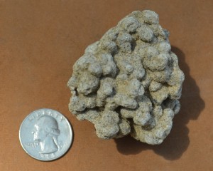
Coprolites - Fossil animal poop, these traces come in a wide variety of unusual bulbous to swirly shapes. People dig up strange-looking concretions all the time in the San Joaquin Valley and claim that they are coprolites. However, coprolites are most likely to be found in non-marine sediments, which make up a very small percentage of the rocks in the San Joaquin Valley. Despite this, coprolites have been reported from the "bone bed", a marine unit in the Miocene Round Mountain Siltone exposed at Sharktooth Hill near Bakersfield. They might also be found in non-marine strata of the Pleistocene Tulare, Miocene Big Blue and Miocene Temblor Formations on the margins of the valley. We have never encountered a San Joaquin Valley coprolite, but we do have a couple of examples on the left from the Miocene of Madagascar. We bought the top one at a geology convention and picked up the bottom one on Ebay. Supposedly they are 16 Million year old petrified turtle turds.
|
 |
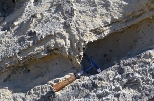
Cruziana - This is a crawling trace created by trilobites, like the one below. It is not found in the San Joaquin Valley, but you may very well get a chance to see one if you take a raft trip down the Grand Canyon. This particular specimen (left) is on the hike up in back of Deer Creek Falls, which is about midway on a float down the canyon. There are lots of nice trace fossils underneath the ledges on the side of the trail above the falls. Note the paired scratch marks on either side of this trace fossil, one for each set of the animal's legs as it crawled along the ancient sea floor. Cruziana is related to Rusophycos, which repesents the resting trace of a trilobite, and Diplichnites, which can represent a variant of the crawling trace of a trilobite .
More Information
|
 |
Cylindrichnus - Long, vertical cylinders to downward-tapering tubes with radial backfill, called menisci, which create a pattern with each tube nested inside another. This structure forms as the organism presses material into the burrow walls, yet tries to maintain an open burrow chamber of constant diameter. Thus, concentric ring patterns in horizontal cross-section are created, with outer menisci getting thinner as inner menisci are pressed against them. Vertical cross-sections will appear as vertical rods within a sometimes tapering tube. Cylindrichnus in some cases represents the lower tube of Rosselia burrows, and horizontal cross-sections may closely resemble Asterosoma.
There is a bit of a controversy as to how the ichnogenus name Cylindrichnus is applied. Some workers (e.g., Frey & Howard, 1985, p. 127-128) restrict it to a vertical tube, whereas others (e.g., Chamberlain, 1978, p. 147) appear to apply it to traces that might be classified by others as Conichnus. The outcrop example on the left is from the Middle Miocene Buttonbed Sandstone Member of the basal Monterey Formation exposed at Buttonbed Hill on Twisselman Range (West Side San Joaquin Valley). It is most likely also the lower tube of a Rosselia burrow, as Rosselia is abundant in this particular bed.
|
 |
Diplichnites - Small, paired trackways that are made by organisms with two sets of legs are known as Diplichnites. The example on the left is a Wikipedia photo of mutiple crawlways in a marine sandstone of the Cambrian Elk Mound Group of Wisconsin, and these particular tracks may very well have been made by trilobites, or similar organisms. Diplichnites traces can also be made by insects in modern to ancient, non-marine environments. Because the trace can be made by a wide variety of animals in a wide variety of enviroments, it tends not to be as useful as other traces for environmental interpretations.
More Information
|
 |
Diplocraterion - U-shaped tubes with concave-up spreite between the pairs of tubes. Diplocraterion are the classic example of an escape burrow. It is generally found in rocks that represent marginal marine settings, such as tidal flats. We have not encountered this trace fossil in the San Joaquin Valley, but on the left is an outcrop example that we spotted in the stairway of the Great Stone Door in the Cumberland Plateau of Tennessee. It is in a slab of sandstone from a tidal flat facies of the Pennsylvanian Raccoon Mountain Formation. The inset photo below shows an unidentified hand sample of a similar trace.
|
| Gastrochaenolites - see Pholad Borings |
 |
 Helminthopsis - A horizontal grazing trace made up of wispy, irregular and discontinuous fecal ribbons that were created by organisms feeding at the sediment-water interface. The burrow makers were either worms, nematodes or who knows what that fed on organic matter that settled out on the sea floor in a very low-energy environment. The trace fossil Helminthoides is similar, except that the individual traces are much longer and wander back and forth in regular geometric patterns of tight loops. The outcrop specimen on the left is from turbidite shales in the Eocene Juncal Formation at Wheeler Canyon in the Transverse Ranges of California, which are located along the south margin of the San Joaquin Valley. Spirophycus can have a similar expression in plan view, and it is possible that this burrow system is better described by that name in other portions of the same bed. The photo on the right shows Helminthopsis burrows in a core of the uppermost Miocene Belridge diatomite from the OB-7 well at Lost Hills oil field (San Joaquin Valley).
|
 |
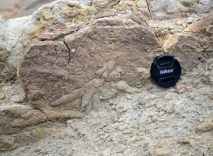
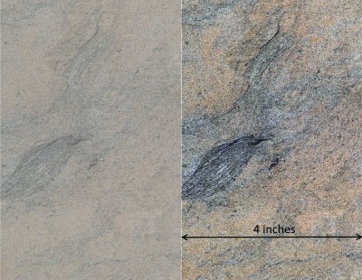
Hillichnus - An interesting and unusual trace fossil that is known primarily from turbidite deposits of the Paleocene Carmelo Formation at Point Lobos, California. Hillichnus is significant because, as with Zoophycos many years earlier, when Hillichnus was first described by Herold (1934) it was mis-identified as a fossil fucoid (seaweed), and it was only after many years of study that geologists finally recgonized it as the burrow of some sort of invertebrate organism (Hill, 1981). Hillichnus is actually a rare trace fossils that few geologists will have an opportunity to see, and although it has not been described from the San Joaquin Valley, who knows, it might be out there somewhere. The link below leads to an informal 2013 article that Ed Clifton of the U.S. Geological Survey (USGS) prepared for the Point Lobos Foundation, and the picture on the left is one taken from Ed's article.
Ed Clifton Article
|
| Ichnites - see Animal Tracks |
| Lamaichnum - see Mammal Tracks |
 |
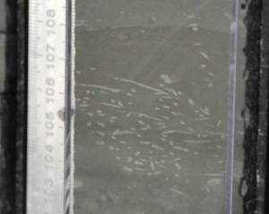
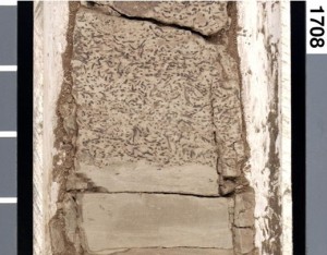
 Macaronichnus - A horizontal, unlined burrow tubes made by a deposit feeder in which the fill is identical to the enclosing matrix, but has a mantle of grains surrounding the burrow that were selected out and rejected during the feeding process. The grains in this mantle are often dark minerals, such as micas, or they may be grains that are nearly indistinguishable from the matrix grains. Most likely, the burrow organism fed on bacteria that were coating the grain surfaces, and certain grains, such as the darker ones, were less conducive to bacterial growth. Thus, these grains were pushed off to the side. Macaronichnus is generally found as a dense mass of burrows that weathers to resemble a mass of pellets. It was probably excavated by some sort of marine worm, and it is found primarily in shallow-marine, sand-rich rocks that represent low-energy, estuary-type environments. Macaronichnus is similar to, and often confused with, Palaeophycos and Planolites The hand sample on the left was collected in the Miocene Temblor Formation exposed in the hills above Coalinga on the west margin of the San Joaquin Valley. The photo on the right shows Macaronichnus in a core of the Pliocene Etchegoin Formation in the 8147-A well at Lost Hills oil field (San Joaquin Valley). Note who the same material in the matrix also fills the burrows, with a mantle of gray clay faintly outlining the burrows.
More Photographs
|

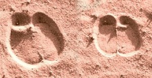 |
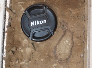
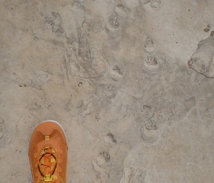
Mammal Tracks (including Lamaichnum) - Various mammal tracks are found on the margins of the San Joaquin Valley, the best known being some camel tracks, which are known as Lamaichnum. These are found in non-marine strata of the Mio-Pliocene Ridge Route Formation that are exposed on the south margin of the valley. Nearby bones have also been found that probably belong to a camel from the genus Miolabis. Both bones and tracks are also reported from the Miocene Mint Canyon Formation, which underlies the Ridge Route Formation.
There are aso Lamaichnum localities in the Barstow and San Diego areas of California, as well as a place in Death Valley known as Camel Track Canyon. In addition, Miocene dog (canine) tracks are reported from the non-marine Big Blue Formation near Coalinga in the north part of the valley. We have a photo of the Ridge Route Formation camel tracks on the Fossil Shells and Bones part of this website, but they are pretty weathered and hard to discern. So here we show a photo in the upper left of a very well-preserved Lamaichnum trackway in Death Valley. Some modern camel tracks are shown in the photo on the lower left. All of these tracks are casts, but depending on the rocks involved it might be possible for tracks to also be preserved as molds.
|
|
Muensteria (Taenidium) - A horizontal unlined burrow that has menisci in it instead of spreite. Although Taenidum is a name that seems to be sometimes applied to the same burrow morphology, the name Muensteria has precedence. The outcrop example shown here is exposed on the underside of a bed at the base of the Miocene Phacoides Sandstone (Miocene Temblor Formation) that crops out in the Temblor Range on the west side of the San Joaquin Valley.
|
 |
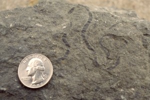
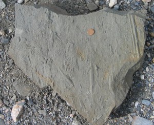
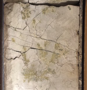
 Nereites - Meandering grazing trails with a furrow down the middle of the trace, and closely-spaced lobes (i.e., fecal pellets) on either side of the furrow. The trails are probably made by annelid worms, gastropods, or arthropods, with variants of the burrow resulting from the type sediment that formed the substrate, and the type of sediment that subsequently buried the trace. For example, sandy substrates that were covered by sand are thought to result in the Scalarituba trace, whereas firm, sandy substrates covered by shale result in the Nereites trace. Wetter, softer substrates that may be either at a sand-mud or mud-sand interface probably result in the Neonereites trace, which is discussed in more detail below.
a = Scalarituba, b = Nereites, and c & d = Neonereites
The example on the left is in a Paleozoic shale in the Maroon Formation that was found on the slopes of South Maroon Peak in the Colorado Rockies. However,these trace fossils can be found also in turbidites of the San Joaquin Valley in the Cretaceous Moreno and Panoche Formations, and in the Sacramento Valley in the Cretaceous Great Valley Sequence.
|

 |
 Neonereites - Meandering grazing trails that are similar to the Nereites trace discussed above, and that were probably created by the same organism, but differ in the absence of a furrow down the middle of the trace. The absence of the median furrow is thought to result from a softer, wetter sediment substrate of either sand or mud, followed by burial beneath the opposite lithology (i.e. soft sand buried by shale, or soft shale buried by sand). These conditions resulted in the inward slumping/movement of fecal pellets placed on the sides of the trail so that the furrow in the middle became obscured and no longer discernable.
The example on the upper left is a hand sample of a Paleozoic shale in the Maroon Formation that was found on the slopes of South Maroon Peak in the Colorado Rockies. The example of the trace on the lower left is in the Cretaceous Venado Sandstone of the Great Valley Sequence exposed at Monticello Dam in the Sacaramento Valley. Similar traces can be found in the Cretaceous Moreno and Panoche Formations in the San Joaquin Valley. Two small Neonereites burrows in cross-section are shown in the core on the right in the thin shale between a rippled turbidite sandstone below (Bouma C) and a massive sand above (Bouma A). The core is from the Miocene Stevens Sandstone (Monterey Formation) in the 488-29 well at North Coles Levee oil field (San Joaquin Valley).
|
|
 Ophiomorpha - A curvilinear to straight, vertical to inclined burrow that has fecal pellets lining the burrow walls to reinforce them and prevent the walls from collapsing in high-energy, shifting-sand environments. Usually straight and unbranched, a few specimens, such as the example on the left, are Y-branched. This burrow in modern environemnts is made by ghost shrimp (Callianassa).
Although generally considered to be a shallow-marine burrow, it does occur in many of the turbidite sandstones of the San Joaquin Valley that are said to represent deep-water deposition, down to perhaps bathyal depths. This apparent dilemma may be explained by the syndepositional rafting of shallow-water sediments that contain Ophiomorpha into deeper water, and/or simply deepening the water depth range in which the Ophiomorpha burrow makers are thought to live. Another possiblility is that the turbidite sandstones were actually deposited at much shallower water depths than is often assumed.
The examples on the left are from the Miocene Pleito Fomation that is exposed in the Devils Kitchen area of the California Transverse Ranges, which are located along the south margin of the San Joaquin Valley. The photo on the right shows an Ophiomorpha burrow in a core of the Rio Bravo sandstone (Miocene Temblor Formation) from the Union Grites 52 well at Greeley oil field (San Joaquin Valley).
More Photographs
|
Need Outcrop Photo |
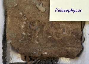 Palaeophycus - A horizontal, passive fill, walled burrow tube that is probably made by a suspension feeder, detritus eater, or carnivore. The burrow tubes are curvilinear to straight, and do not cross. The fill is identical to the surrounding matrix, and the burrow walls are stabilized by some sort of lining that allowed the organism to dwell in the burrow without it collapsing. Palaeophycus is typically found as separate burrows, and not as masses of burrows. It is found in both shallow-marine and terrestial settings, with worms of some sort being the likely burrow makers in marine rocks, and insects being the likely burrow makers in non-marine rocks.
Palaeophycos is similar to, and often confused with, Macaronichnus and Planolites. It has also been suggested that many burrows identified as Terebellina, should actually be renamed as Palaeophycus. The photo on the right shows Palaeophycus traces in a core of the Pleistocene Tulare Formation from the EXF 376T well at Midway-Sunset oil field (San Joaquin Valley).
Palaeophycus - A horizontal, passive fill, walled burrow tube that is probably made by a suspension feeder, detritus eater, or carnivore. The burrow tubes are curvilinear to straight, and do not cross. The fill is identical to the surrounding matrix, and the burrow walls are stabilized by some sort of lining that allowed the organism to dwell in the burrow without it collapsing. Palaeophycus is typically found as separate burrows, and not as masses of burrows. It is found in both shallow-marine and terrestial settings, with worms of some sort being the likely burrow makers in marine rocks, and insects being the likely burrow makers in non-marine rocks.
Palaeophycos is similar to, and often confused with, Macaronichnus and Planolites. It has also been suggested that many burrows identified as Terebellina, should actually be renamed as Palaeophycus. The photo on the right shows Palaeophycus traces in a core of the Pleistocene Tulare Formation from the EXF 376T well at Midway-Sunset oil field (San Joaquin Valley).
More Photographs
|
 |
Paleodictyon - This is a geometrically regular trace fossil that resembles a raised honeycomb pattern. The holes that appear on the surface are actually small vertical shafts that connect to a network of tunnels beneath. Adolf Seilacher interprets this trace to have been made by an organism that lived at bathyal depths on the sea floor and used the tunnels to either capture micro-organisms to eat, or raised micro-organisms for food. Others interpret this trace to be the body fossil of a sponge-like creature. Although Paleodictyon has been described from turbidite shales of the Cretaceous Great Valley Sequence that are exposed on the west side of the San Joaquin Valley, we do not have any pictures of them to share.
 The example shown on the far left is from a Miocene sandstone in the Tabernas Basin of southeastern Spain. Note the groove casts that are interspersed with the Paleodictyon traces. A modern Paleodictyon from the deep Atlantic Ocean is shown below and left. The photo is one of several taken by Seilacher and colleagues on deep-ocean submersible dives in the Atlantic Ocean that were undertaken to study the trace.
More Information
|
 |
Pebble burrows - These interesting burrows look like Ophiomorpha, but have pebbles in the burrow walls along with fecal pellets. Possibly the shrimp making the burrows encountered pebbles while digging and simply pushed them out of the way into the sides of the burrow. This trace is abundant in the uppermost Miocene Santa Margarita Formation in the hills above Coalinga where it is often associated with giant Ostrea titan oysters.
More Photographs
|
|
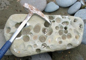
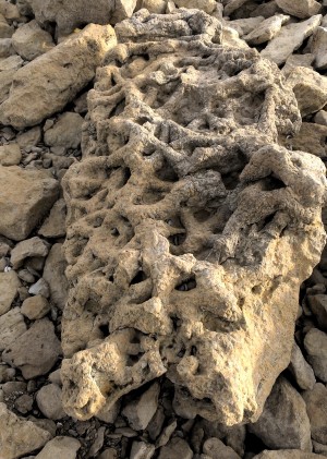
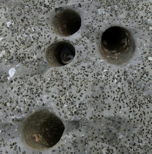
Pholad borings (Gastrochaenolites) - A trace made by pholads, which are clams that have the ability to grind burrows into solid rock. The example on the left shows pholad borings in a dolomite clast in the Carneros Sandstone (Miocene Temblor Formation) that is exposed in the Temblor Range on the west side of the San Joaquin Valley. The clast is probably from an exhumed hardground eroded from the underlying Santos Shale. Below it is a pholad buried bed in a turbidite setting from the Mio-Pliocene Towsley Formation exposed at Towsley Canyon in the Transverse Ranges on the southern margin of the San Joaquin Valley. Gastrochaenolites is the official ichnospecies name for this trace. The presence of clam borings in this turbidite indicates that it is probably not the deep water setting that most geologists want to interpret for the Towsley Formation. A modern beach rock with pholad clam borings is shown below. Notice how some of the holes in the rock still have clams in them.
|
 |
Planolites - A horizontal, active fill, unlined burrow tube made by a deposit feeder, in which the fill differs from the surrounding matrix. The burrow tubes are curvilinear to straight, and do not cross. It is typically found as separate burrows and not as masses of burrows, with the primary purpose of the burrow was mobility, less so feeding. It is generally found in shallow-marine rocks. The specimen on the left is from the Carneros Sandstone (Miocene Temblor Formation) exposed at Jack Canyon, just off of Highway 46 on the west sdie of the San Joaquin Valley. The photo on the right shows Planolites traces in the upper part of a core of the Belridge diatomite from the OB-7 well at Lost Hills oil field (San Joaquin Valley). The lower part of this core sample has sparse Helminthopsis trace fossils. Planolites is similar to, and often confused with, Palaeophycos and Macaronichnus
More Photographs
|
 |
Rhizocorallium - A non-branching, horizontal to slightly inclined, U-shaped trace with a peripheral tunnel and concave laminations called spreite between the tunnels. It is more or less a horizontal version of a vertical U-shaped trace with spreite known as Diplocraterion. Rhizocorallium is generally found in shallow-marine rocks, and it has been suggested that it is a combination feeding trace/dwelling burrow of an annelid worm, or possibly even some sort of arthropod, such as a burrowing shrimp. An outcrop example is shown on the left from the Phacoides Sandstone (Miocene Temblor Formation) exposed at Salt Creek in the Temblor Range, which is on the west side of the San Jaoquin Valley. The photo on right shows a Rhizocorallium burrow in a core of the Phacoides Sandstone (Miocene Temblor Formation) from the 17-2N well at South Belridge oil field (San Joaquin Valley).
More Photographs
|
 |
 Rhizoliths (Vegemorphs) and Rhizocretions - Fossil root systems that become encased in mineral matter during burial are known as rhizoliths or vegemorphs, and result when organic acids associated with roots alter the surrounding soil to create enclosing concretions. Rhizoliths may also form when roots decay, and carbonate precipitates into the remaining voids. Individual roots that display a concentric ring structure when viewed in cross-section are sometimes referred to as "rhizocretions". Mikuláš (1999) places rhizocretions and other types of rhizoliths in the proposed trace fossil class Corrosichnia that represents traces arising from the corrosive action of plant roots.
An outcrop example of a rhizocretion is shown above and left. It is from a mudstone beneath the Putah Tuff that is exposed at Putah Creek (near Lake Berryessa) on the west side of the Sacramento Valley of northern California. Below and left is a photo that shows Pleistocene rhizoliths on Santa Rosa Island (offshore California) that formed when vegetation stabilized ancient sand dunes. Carbonate later precipitated into voids left behind by the decaying roots, and subsequent wind erosion excavated the resulting rhizoliths. The photo on the right shows rhizocretions in a core of the Miocene Temblor Formation from the S34-404ST1 well at Coalinga oil field (San Joaquin Valley).
More Photographs
|
 |
Root Traces - Bioturbation structures that result from plant roots growing down and spreading into sediment are known simply as root traces, whereas rhizoliths (which include rhizocretions) represent geochemical alterations of the soil by plant roots. Mikuláš (1999) places plant bioturbation structures in the proposed trace fossil class Sphenoichnia, whereas rhizocretions and other rhizoliths are Corrosichnia.
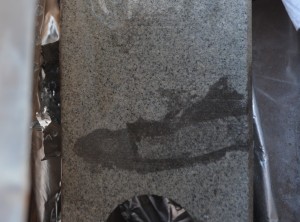
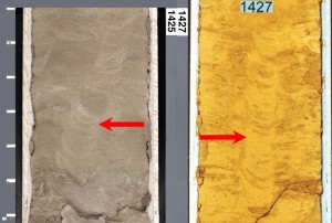
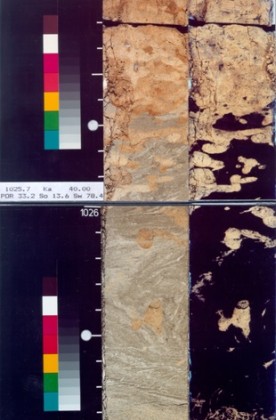
 Shown on the left are two root traces in a paleosoil in some Triassic redbeds in England. Very similar traces are found in the Oligocene Sespe Formation in the California Transverse Ranges (south margin of the San Joaquin Valley). The photo on the far right shows a root trace in a core of the Pleistocene Tulare Formation in the 9601-3 well at South Belridge oil field (San Joaquin Valley), and below and right is a black light (UV) image of the same core. Closer examination of the black light photo will reveal two adhesive meniscate burrows (insect burrows) at the base of the root - an indication that the insects that made the burrows may have been feeding on roots.
|
 |
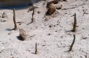
  Rootlets - Marsh plants such as Tule Grass and Cattails have masses of small diameter roots that are pervasive throughout the wet, muddy marsh bottoms they are rooted in. If conditions are right, these rootlets are preserved as cylindrical bits of organic matter scattered throughout the rock. Although rootlets technically are a body fossils and not traces, it seems appropriate to include them with rhizocretions (Corrosichnia) and root bioturbation structures (Sphenoichnia), which are traces.
The photo on the left is a core of the Temblor Formation at Coalinga oil field in the 977-2 well (San Joaquin Valley). The rootlets have a dendritic character, and there is a coating of yellow sulphur associated with them resulting from decay and alteration of the plant matter. The photo on the far right shows a longitudinal view of rootlets in a core of the Miocene Temblor Formation from the 34-404ST well at Coalinga oil field (San Joaquin Valley). The photo on the immediate right shows a cross-section view of rootlets a core a diatomaceous mudstone from the Pleistocene Tulare Formation in the Maxwell 860 well at Midway-Sunset oil field (San Joaquin Valley).
|
 |
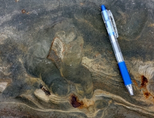
 Rosselia & Conichnus - Vertical, multi-lined burrows with concentric cone-in-cone structures that point downward. Both cut across bedding and constrict downward. Rosselia transitions downward into a long, sometimes curved tube, whereas Conichnus generally tapers donwward to a point, or has a blunt base. Both probably represent dwelling traces of some sort of a sessile organism, such as a sea anenome, that moved its burrow upward in response to sedimentation. As such, both are "escape burrows". When eroded out and redeposited horizontally, both traces may resemble Asterosoma, with a concentric ring structure around a central sand-filled tube.
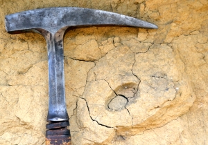
Shown on the upper left is a Conichnus from the Buttonbed Sandstone (Miocene Temblor Formation) exposed at Chico-Martinez Creek in the Temblor Range, on the west side of the San Joaquin Valley. Note that it terminates downward to a point. However, some workers restrict Conichnus to more teacup-shaped traces that have a blunt base, and they might classify the burrow on the left as Cylindrichnus - especially when the burrow has a form that is tall and narrow.
Shown on the lower left is another Conichnus (or Cylindrichnus), which could easily be classified instead as a Rosselia, as it appears to transition into a tube behind the head of the rock hammer. It is from an outcrop of the late Miocene Santa Margarita Sandstone that is exposed near Skunk Hollow in Coalinga in the north part of the Valley. A Rosselia burrow in an unknown core is shown on the right, and superimposed on the photo is a drawing of the burrow by Adolf Seilacher (modified from Chuck D. Howell's clastics.com website, which has a nice section on Rosselia that is worth a read).
|
 |
Rusophycos - This is a resting trace of the undersides of trilobites, which is an ancient crab-like animals similar to the one in the animation below. It is not found in the San Joaquin Valley, but you may very well get a chance to see one if you take a raft trip down the Grand Canyon. The specimen on the left is on the hike up in back of Deer Creek Falls, which is about midway on a float down the canyon. There are lots of nice trace fossils underneath the ledges on the side of the trail above the falls. Rusophycos is related to Cruziana, which repesents the crawling trace of a trilobite.
More Information
|
 |
Scalarituba - Horizontal to slightly oblique, meandering, seldom straight burrows with backfilling menisci that form slightly curved ridges between the burrow walls such that fairly uniform, equal-sized depressions separate the ridges. It has been suggested that Scalarituba results when the organism resposible for the burrow tunnels through the middle of a sand bed, whereas Nereites and Neonereites traces result if the same organism works the top of the bed. Thus, Nereites and Neonerites are grazing trails on top of the sediment, whereas Scalarituba represents deposit feeding (tunneling and mining) behavior within the sediment. The example on the left is a Wikipedia photo from some Miocene to Oligocene outcrops at Algeciras near the southernmost tip of Spain. Although idenitified in Wikipedia as Neonereites, we believe this trace to be a classic example of Scalarituba with the raised meniscate ridges in the burrow clearly evident. We have not observed Scalarituba in either the San Joaquin Valley or in any of the adjacent California basins. However, because it is essentially a variety of Nereites and Neonereites, it is likely to be found in either the Cretaceous Great Valley Sequence of the Sacramento Valley, or the Cretaceous Moreno and/or Panoche Formations of the San Joaquin Valley.
|
 |
Scolicia - Horizontal, meandering burrows that are filled with concave, backfilling laminations showing bilateral symmetry. Two parallel grooves separated by a ridge are found at the base of the burrow, when developed on top of sandstones, but the most common expression is as a series of concave menisci developed in between a burrow lining. The tops of burrows may show a feather-stitch pattern where two parallel trains of menisci with opposite symmetry meet (see example below and left).
 The burrows are generally found between bedding planes on top of shallow- and deep-marine sandstones that are overlain by shale. Scolicia is thought to be made by burrowing gastropods with bilateral symmetry that tunneled between bedding planes looking for food, or more likely by burrowing heart-shaped urchins, called spatangoids, that have bilateral symmetry with a mouth at the notch between the lobes of the heart and an anus at the point. The burrows are generally found between bedding planes on top of shallow- and deep-marine sandstones that are overlain by shale. Scolicia is thought to be made by burrowing gastropods with bilateral symmetry that tunneled between bedding planes looking for food, or more likely by burrowing heart-shaped urchins, called spatangoids, that have bilateral symmetry with a mouth at the notch between the lobes of the heart and an anus at the point.
|
 |
Scoyenia - Vertical, non-branching tubes with walls that have a "rope-like" texture. These traces are generally attributed to insects. We do not have an outcrop nor core example of Scoyenia, but the walls of the modern mud wasp nests on the rock on the left have the correct texture, and if these were located in the ground they would correctly be called Scoyenia. The rope-like texture results from the insect either regurgitating or excreting mud that it has ingested, and using this material to construct the burrow walls. Burrowing wasps do the same, and their burrows in some cases are modern equivalents of Scoyenia.
|
 |
 Skolithos - Simple, vertical to slightly inclined tubes that have smooth walls with linings and structureless fill. The tubes are sometimes J-shaped, and they never branch or cross. Usually found in rocks that represent shallow-marine environments, they are also found sometimes in non-marine and deep-marine facies. The famous "pipe rock" of Scotland is a Cambrian sandstone containing closely spaced Skolithos burrows. Another well known "pipe rock" is the Ordovician to Silurian Tumblagooda Sandstone of Kalbarri National Park in Western Australia. The outcrop example on the far left is from the Eocene Matilija Formation exposed in the California Transverse Ranges, which are located along the south margin of the San Joaquin Valley. The photo on the right shows a Skolithos trace in a core of the Phacoides Sandstone (Miocene Temblor Formation) from the 516-8 well at South Belridge oil field (San Joaquin Valley).
More Photographs
|
| Taenidium - see Muensteria |
 |
 Teichichnus - A non-branching, unlined, vertical feeding trace characterized by concave-up laminations called spreite, which are tabular, curved laminations that are formed as the organism tunnels back and forth through the sediment in search of food. The organism on each back-and-forth pass moves just enough to avoid reworking a previously mined area. The specimen on the left is from the Eocene Coldwater Formation exposed at Sespe Canyon in the California Transverse Ranges, which are located along the west margin of the San Joqaquin Valley. Note the nice articulated bivalve in the middle of the photo. The photo on the right shows a Teichichnus trace in a core of the Belridge diatomite from the OB-7 well at Lost Hills oil field (San Joaquin Valley).
More Photographs
|
 |
 Terebellina - Unbranched, horizontal tubes with walls composed of sand grains and/or fragments of skeletal material held together by an organic cement. The appearance is usually that of white rings in a fine-grained dark matrix. There is some debate as to whether Terebellina is a true burrow, or simply cross-sections of ostracods, large benthic forams, or some other spherical organism with a carbonate exoskeleton. It has also been suggested that many Terebellina identifications may actually be Palaeophycus burrow traces. An important observation is that Terebellina, though first described in 1904 by Ulrich, is not included in
Häntzschel (1975).
Terebellina - Unbranched, horizontal tubes with walls composed of sand grains and/or fragments of skeletal material held together by an organic cement. The appearance is usually that of white rings in a fine-grained dark matrix. There is some debate as to whether Terebellina is a true burrow, or simply cross-sections of ostracods, large benthic forams, or some other spherical organism with a carbonate exoskeleton. It has also been suggested that many Terebellina identifications may actually be Palaeophycus burrow traces. An important observation is that Terebellina, though first described in 1904 by Ulrich, is not included in
Häntzschel (1975).
The photo on the left shows several Terebellina burrows in the basal sandstone (Brooks Sandstone) of Pliocene Sisquoc Formation in the Victory G7 well at East Cat Canyon oil field (Santa Maria Basin), whereas the photo on the right shows Terebellina burrows in a core of the Phacoides Sandstone (Miocene Temblor Formation) from the 518-8 well at South Belridge oil field (San Joaquin Valley).
|
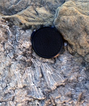 |
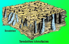
Teredolites - Shipworms are clams that bore into wood floating in sea water. They are also known as "Teredo worms", and their preserved traces are known as Teredolites. When a piece of wood colonized by shipworms is buried, the borings fill with sediment, and as the wood rots away, it is replaced by sediment also. Although the borings are usually lined with a calcareous tube, this may or may not be preserved with deep burial. Some Teredolites burrows may look very similar to masses of Macaronichnus burrows, but Teredolites will have a much more limited extent, whereas Macaronichnus often makes up an entire bed that can continue laterally for tens of feet. An outcrop example of Teredolites is shown on the left from the Eocene Coldwater Formation exposed at Sespe Canyon in the Caifornia Transverse Ranges, which are located on the south margin of the San Joaquin Valley. Note that the calcareous tubes lining the borings are still preserved. We were once told that this example might also be Sipunculid worms. However, Sipunculids do not secrete calcium carbonate shells, whereas Teredo worms do.
|
 |
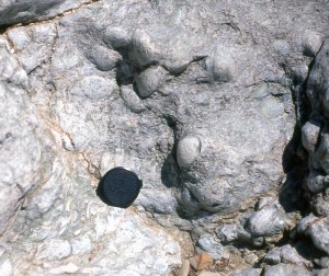
Thalassinoides - A complex network of branching to interconnected burrows that extends both vertically and horizontally, with the burrow mass often defining a single bed. The burrow walls are lined, which indicates a dwelling burrow, but without fecal pellets imbedded in the burrow walls. Individual burrow segments may closely resemble Ophiomorpha, and the burrow may in fact be transitional with Ophiomorpha. Both burrow types in modern settings are the work of burrowing shrimp. The burrows sometimes resemble preserved mudcracks.
Thalassinoides is found in both muddy and sandy sediments in shallow-marine settings. The outcrop example on the left is from the Cretaceous section exposed near the San Luis Dam Vistor Center in the northern part of the San Joaquin Valley. The photo on right shows sand-filled Thalassinoides burrows in a core, where the burrows are in shale strata below an unconformity at the top of the Miocene Temblor Formation. The core is from the 9-4T1 well at Coalinga oil field (San Joaquin Valley).
More Photographs
|
| Trypanites - see Worm Borings |
 |
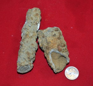
Worm Borings (Trypanites) - Various marine worms, for example polychaete or sipunculid worms, are able to bore into hardgrounds and create distinctive trace fossils that are non-branching, vertical to curving, small-diameter penetrations of the media. Some worms even have the ability to bore into solid rock, possibly by using acids to dissolve their way into the rock, and worm borings in solid rock are known as trypanites.
The modern example on the left is a Wikipedia photo that shows a dense grouping of small-diameter trypanites borings interspersed between much larger diameter pholad clam borings in a calcite-cemented rock collected on the northwest coast of either France or Belgium somewhere inbetween Calais and Boulogne.
The core photo top and right shows a small 1.5" clast of diatomite that is bored into by some sort of worm-like organism. It is probably two, separate worm borings superimposed one on the other, with one deviating left and the other deviating right. It may indicate the presence of a burrowed hardground somewhere in the section. It is from a core of the Brooks Sandstone (basal sand of the Pliocene Sisquoc Formation) in the Victory G7 well at East Cat Canyon Field in the Santa Maria Basin, which is in California on the west side of the San Andreas Fault from the San Joaquin Valley. Below it is a worm boring in an interval of shale in a core of the upper Eocene Kreyenhagen Formation immediately below a Temblor-Kyreyenhagen unconformity that represents about 40 million years of missing section. This example is from the 27-308 well at Coalinga oil field (San Joaquin Valley).
|
 |
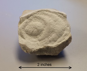
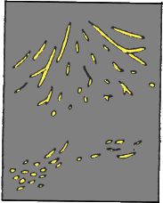
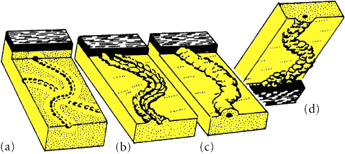
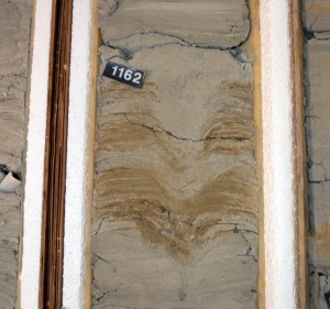
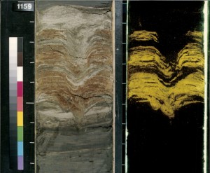
 Zoophycos - The amazing photo in the upper left is from Dr. Peter Pervesler's website, and shows an ancient Zoophycos burrow. Pervesler and A. Uchman carefully excavated the burrow out of the Miocene Grund Formation in Austria with an air brush. The burrow shows spreite radiating out from a central tube in a downward spiral to form a conical shape. The spreite in map view have "rooster tail" patterns that spiral out from a central point, as shown below and right. By contrast, the spreite in cross-section are arranged in parallel trains, in with each train resembles a Rhizocorallium burrow, as in a core of recent deep-sea mud shown on the far right that was collected by the JOIDES Ocean Drilling Program. Zoophycos characterizes deep-marine shales that are interbedded with turbidites, and it is often associated with Chondrites.
 The photo below left is a cross-section view of a probable Zoophycos burrow that starts in a turbidite sandstone and expands downward and outward, like a christmas tree, into the underlying shale. Note the resemblance of some of the spreiten-adorned burrow branches to Rhizocorallium traces. This example was found in the Cretaceous La Jolla Formation exposed in sea cliffs at La Jolla Cove in San Diego, California. Similar traces are found in outcrops of the Cretaceous Great Valley Sequence exposed on the west side of the San Joaquin Valley. The photo in red is the type Zoophycos specimen at the Museum of Natural History in Verona in Italy, and beside it a drawing made in 1855 by Abramo Massalongo when he first described Zoophycos, and mis-identified it as fossil seaweed (fucoids).
More Photographs
|
Non-biologic Traces
(also known as pseudo-fossils)
 |
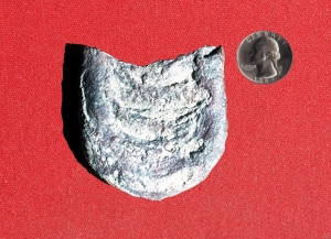
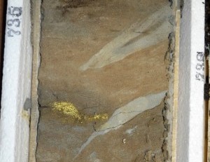
 Armored Mud Balls - Because of their concentric appearance, these structures, along with weathering rinds, might be confused with rhizocretions (a type of root trace). Armored mud balls form in both fluvial (more common) and marine settings (less common) when a ball of mud gets rolled around on a beach, and acquires a coating of sand grains. Though less common, they may also form when sedimentary clasts are rolled around on a bank of mud to acquire a clay coating. Similar, but rare, structures found in turbidites are elongate, spindle-shaped features that form at the base of sediment gravity flows, with the direction of transport being perpendicular to the long axis of the spindle. These "spindles" generally have cores of mud, and an outer coating of sand, indicating that mud was rolled along at the base of the flow, with sand grains sticking to the mud to form a coating.
 The upper left photo shows a giant mudball in estuary deposits of the Lower Miocene Temblor Formation exposed near Coalinga Field on the west side of the San Joaquin Valley. It is made up of successive layers of mud, without a coating of sand grains. Below and left is a cross-section view in outcrop of a "turbidite spindle" that clearly shows a core of mud. It is from the Lower Miocene Carneros Formation exposed at Cedar Creek (near Bitterwater Canyon), which is also on the west margin of the valley. Another one of these turbidite features, one with a conspicuous core of mud, is shown in the inset photo on the left, which is from the Mio-Pliocene Towsley Formation at Towsley Canyon in the mountains on the south margin of the valley. The core on the right shows armored mud balls in core from fluvial deposits of the Pliocene Tulare Formation in the South Belridge 5514A well at South Belridge Field.
|
 |
Dewatering Pipes - Although they may look very much like burrrows and/or root traces, dewatering pipes result when water-charged, rapidly deposited sediment compacts, and the contained water moves up through overlying strata along zones of weakness. De-watering pipes are characteristic of the Bouma A and Lowe S3 layers of turbidites. The outcrop example on the left is from the Middle Eocene Cozy Dell Formation exposed in Sespe Canyon in the California Transverse Ranges that represent the south margin of the San Joaquin Valley. The right-hand photo shows dewatering pipes in a core of the Lower Miocene Temblor Formation from the 34-404ST well at Coalinga oil field (San Joaquin Valley).
|
 |
 Dish Structures - As the sand suspended in a turbidity current starts to settle out, insipient clay laminations may begin to form concurrent with the upward movement of water that has been forced out from between the settling grains. Dewatering pipes within the sand may then form and distort these clay laminations to form concave-up patterns that resemble small dishes, with an overall pattern that may be confused by some as bioturbation. Some nice dish structures are shown on the left in the Point of Rocks sandstone at Salt Creek in the Temblor Range (west margin of the San Joaquin Valley). Though very faint and hard to see, there are dish structures in the two cores shown on the right - both from the 36X-14 well in the Middle Miocene Nozu Sandstone (Monterey Formation) at Stockdale Ranch oil field (San Joaquin Valley).
More Photographs
|
 |
 Flute Casts - These are found on the underside of turbidite sandstone beds, generally on the underside of the Bouma B interval of parallel laminations. They result from small eddies in a turbulent flow, in which the eddies start to excavate a circular scour in the sediment below, but then dissipate and taper off in the downstream direction. Flute casts conceivably could be confused with the resting traces of an organism. The outcrop example shown on the left is from the Eocene Point of Rocks sandstone exposed at Salt Creek in the Temblor Range on the west margin of the San Joaquin Valley, and it shows the paleocurrent direction going from right to left. On the right is a flute cast in a core of the Miocene Carneros Formation from the 50X-27 well at South Belridge oil field (San Joaquin Valley). It shows the current direction going from right to left.
|
 |
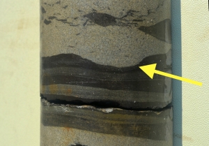
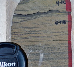 Groove Casts (Drag Casts) - When turbidity currents are transporting sediment, they may drag rocks and shells along at the base of the flow and cut long grooves into the muddy sediment beneath. As sand carried by the current settles out and fills the groove, a groove cast will be formed. These are typically found on the underside of the Bouma B interval of parallel laminations of a turbidite sandstone. Groove casts may resemble, and conceivably could be confused with grazing traces, such as Nereites and Neonereites that are exposed at the base of a turbidite bed. However, most groove casts are straight as a ruler and have a smooth profile, whereas grazing traces typically meander around and have fecal pellets associated with them.
Shown on the left are several parallel groove casts on the underside of a turbidite bed of the Cretaceous Venado Formation at Monticello Dam in the Sacramento Valley of northern California. Notice the isolated cluster of Thalassinoides burrows to the left of the groove casts. The core on the right shows oblique, cross sectional views of three adjacent groove casts, evident between the 4-1B and 4-1C marks as incisions at the base of a laminated sand (Bouma B) that cut down into into a laminated shale (Bouma D) overlying climbing ripples (Bouma C). The core is from the Stevens Sansdstone (Antelope Shale Member of the Miocene Monterey Fm) in the SCL 488-29 well at South Coles Levee oil field (San Joaquin Valley).
|
 |
 Mudcracks - Dessication (shinkage) cracks may form in non-marine mudstones as they dry out in the sun, and are subsequently filled in by sediment. Mudcracks cut across bedding in cross-section view, and form polygonal patterns in map view. Multiple episodes of dessication, with later infilling and re-wetting may be displayed. Although mudcracks in many cases display regular polygonal shapes, they conceivably could be confused with Thalassinoides burrows. Sub-aqueous shinkage cracks known as syneresis cracks are similar to mudracks, but form in limey sediments during contraction of clays in the rock response to salinity changes in an overlying water column. However, syneresis cracks tend be much more discontinous and irregular than most mudcracks.
The outcrop example of mudcracks shown on the left is from ancient lake bed deposits of the Miocene Piru Gorge Sandstone (Ridge Route Formation) exposed along the Old Templin Highway in the California Transverse Ranges (south margin of the San Joaquin Valley). Note the Skolithos burrows scattered amongst the mudcracks. The photo on the right shows a cross-section view of mudcracks in a core of the Pleistocene Tulare Formation from the EXF 376T well at Midway-Sunset oil field (San Joaquin Valley). Note the evidence for multiple episodes of wetting and shrinkage, and also how the light-colored material filling the cracks cuts across bedding.
More Photographs
|
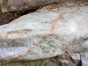 |
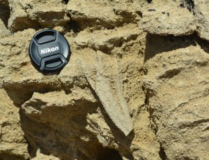
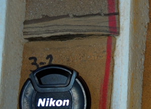
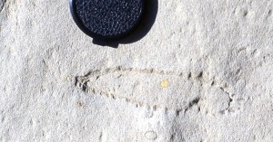
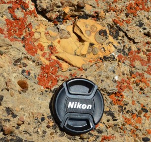
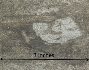
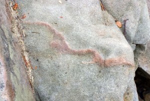
Pseudofossils - Sedimentary structures that are formed by inorganic processes, yet have the appearance of features that originated from living organisms, are sometimes referred to as "pseudofossils" or "fake fossils". The outcrop example on the left has the appearance of the crawling trace of an invertebrate organism when viewed from above (top left photo), but the side view (bottom left photo) shows that it is actually an inclined joint (crack) that is filled with some sort of pink cement that obliquely intersects an undulating bedding surface to generate a linear meandering trace on top of the bed. It is not from the San Joaquin Valley, but it is just such a great example that we need to share it. We found it in the stairway of the Great Stone Door in the Cumberland Plateau of Tennessee on a slab of sandstone from the Pennsylvanian Raccoon Mountain Formation.
|
|
Raindrop Impressions - Not the trace of an organism, but a trace nonetheless. The example on the left is from the Permian Lyons Formation that is exposed near Fort Collins, Colorado, and it is typical of similar specimens found in many of the sandstone quarries in the area. We are not aware of any rain drop imprints that have been observed in rocks of the San Joaquin Valley, but they would certainly be possible in the non-marine Tulare or Big Blue Formations, or perhaps in non-marine facies of the Temblor and other formations on the east side of the valley. Rain drop imprints resemble, and conceivably could be confused with Skolithos traces when observed in plan view on the top of a sandstone bed.
|
 |
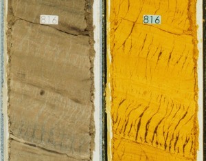 Tiger-stripe Diatomites - This interesting structure closely resembles molar tooth structure, which is a texture found in certain Cambrian, fine-grained carbonates, and is so called because it resembles the fossil teeth of ancient Mammoths. However, the so-called "tiger-stripes" shown here are sinusoidal-shaped concentrations of clay and diatomite that are finer grained than the surrounding matrix. A number of interpretions have been proposed, including syneresis cracks, and tension fractures resulting from downslope movement during earthquakes. However, both of these interpretations require filling of an open fracture, for which there does not seem to be evidence. The most reasonable interpretation is that these stripes are Intrastratal Microfractured Zones (IMZs) that represent zones of shear that developed during downslope movement and shaking of a water-charged diatomite, probably during earthquakes. Fine-grained particles within the diatomite migrate into the shear zones as they develop, and the zones are deformed into the s-shaped geometries that characterize the tiger stripes. The outcrop example shown on the left is from the lower Antelope Shale exposed along Chico-Martinez Creek in the Temblor Range on the west margin of the San Joaquin Valley. The photo on the right shows IMZs in a core of the Upper Miocene Marvic (Stevens) Sandstone from the Dickinson Trust 1-168 well at North Midway oil field (San Joaquin Valley).
|
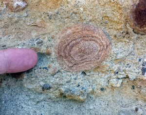
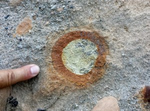 |
Weathering Rinds - Because of their concentric appearance, these structures, along with armored mud balls, might sometimes be confused with rhizocretions (a type of root trace). Weathering rinds form in non-marine settings when rounded, sedimentary clasts collecting in a stream bed are subaerially weathered to form an oxidized outer layer surrounding in inner unweathered core. Both of the examples in the photos on the left are from the Oligocene-age Sespe Formation exposed at Portrero John Creek in the Topatopa Mountains, which are part of the Transverses Ranges that form the south margin of the San Joaquin Valley.
|
disclaimer
|


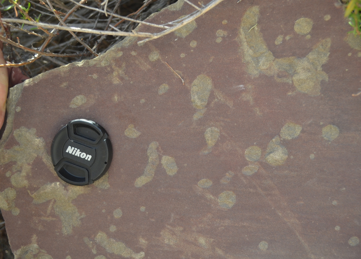


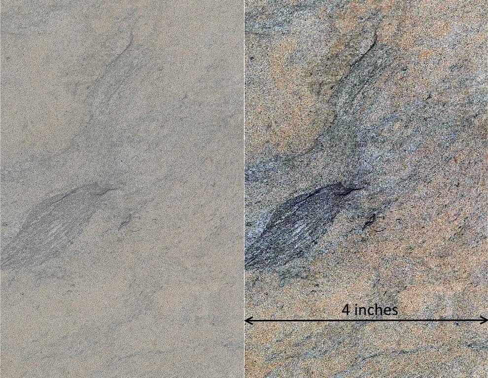
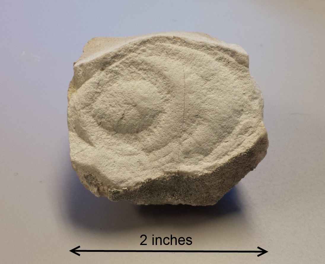
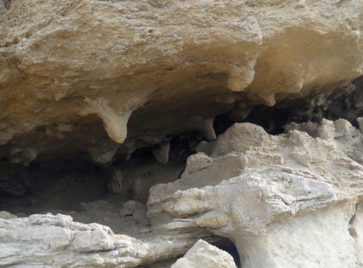
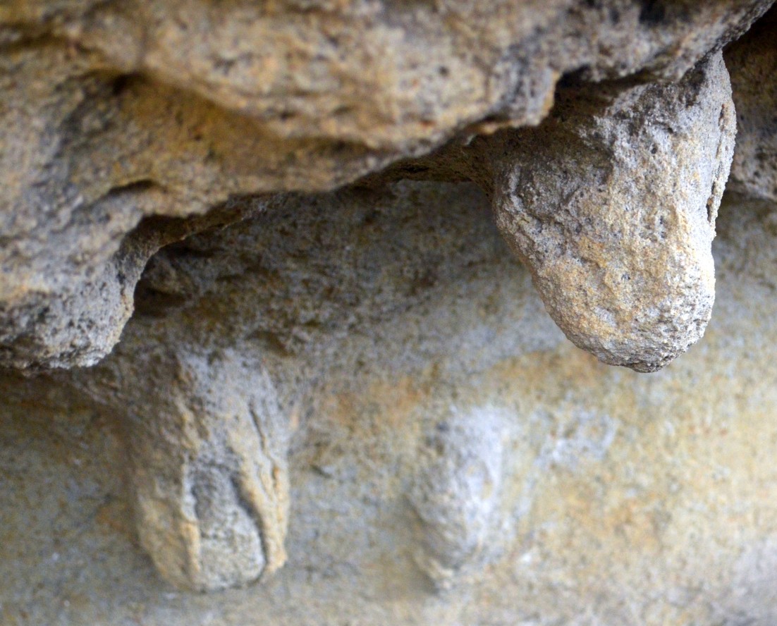
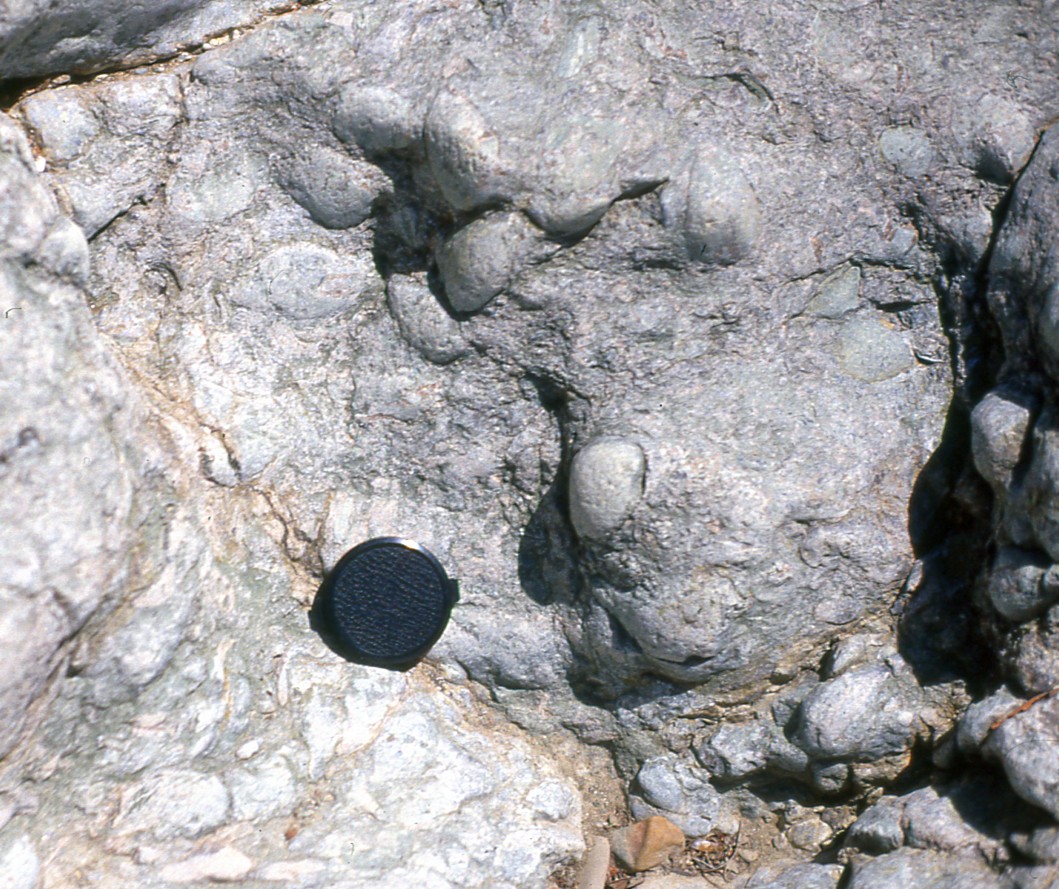

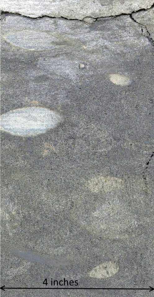
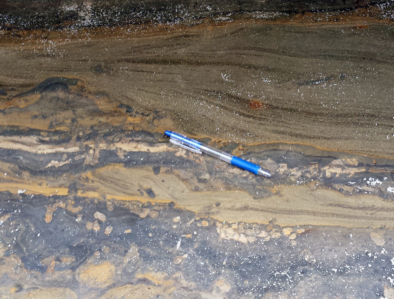

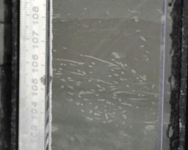
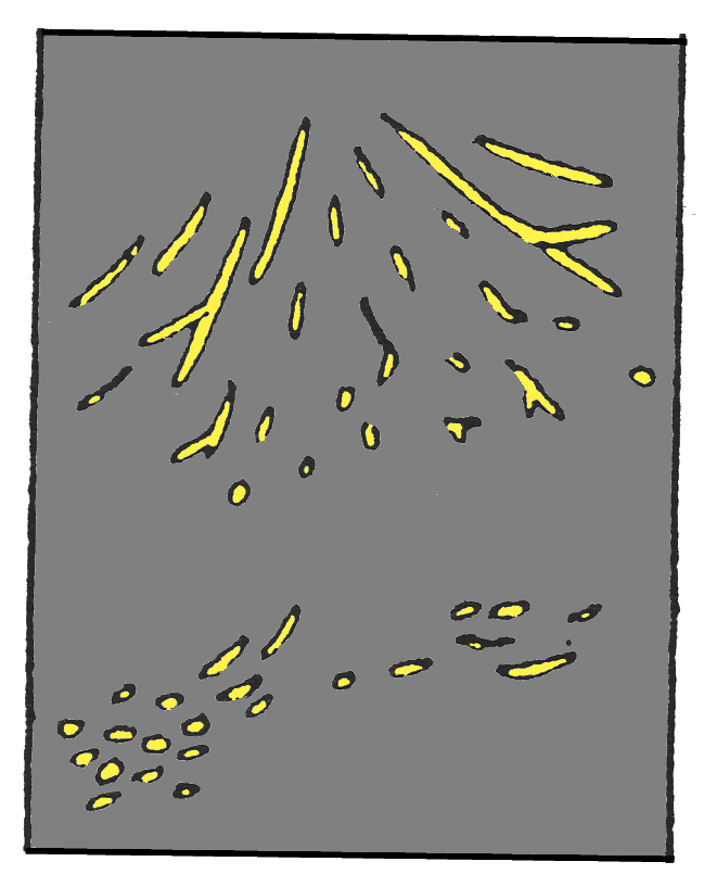
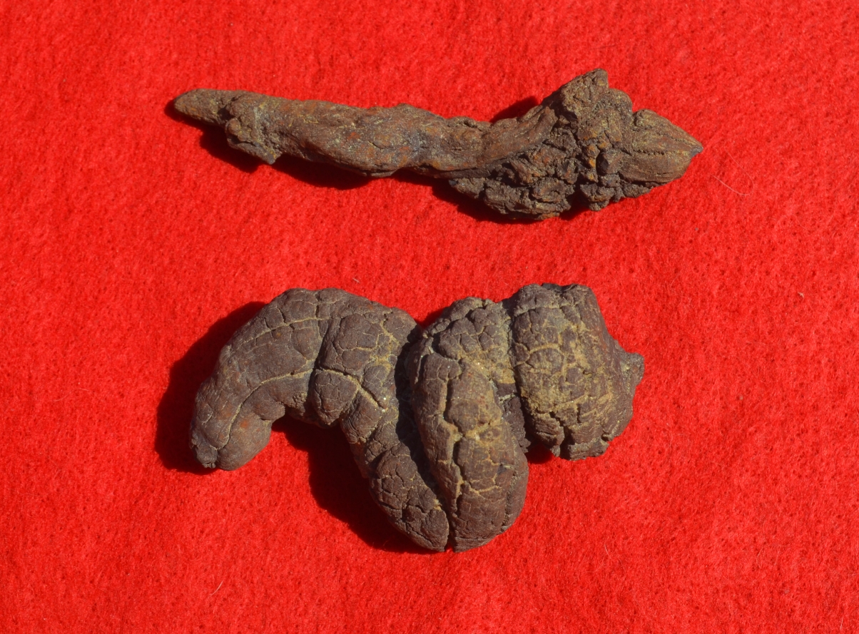
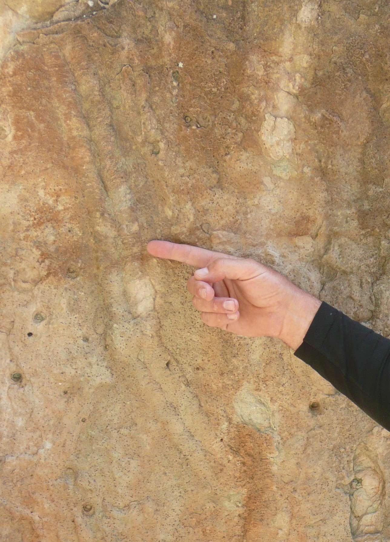
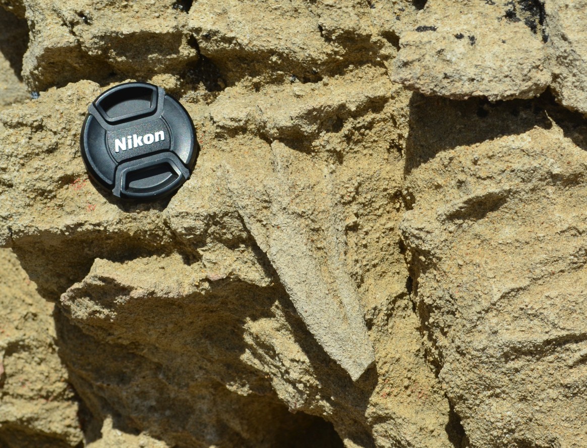
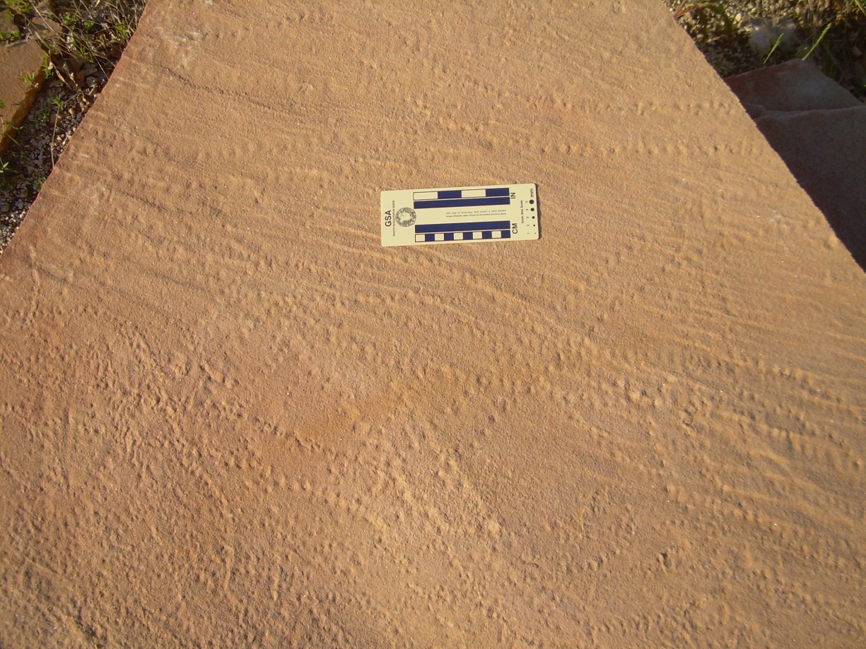
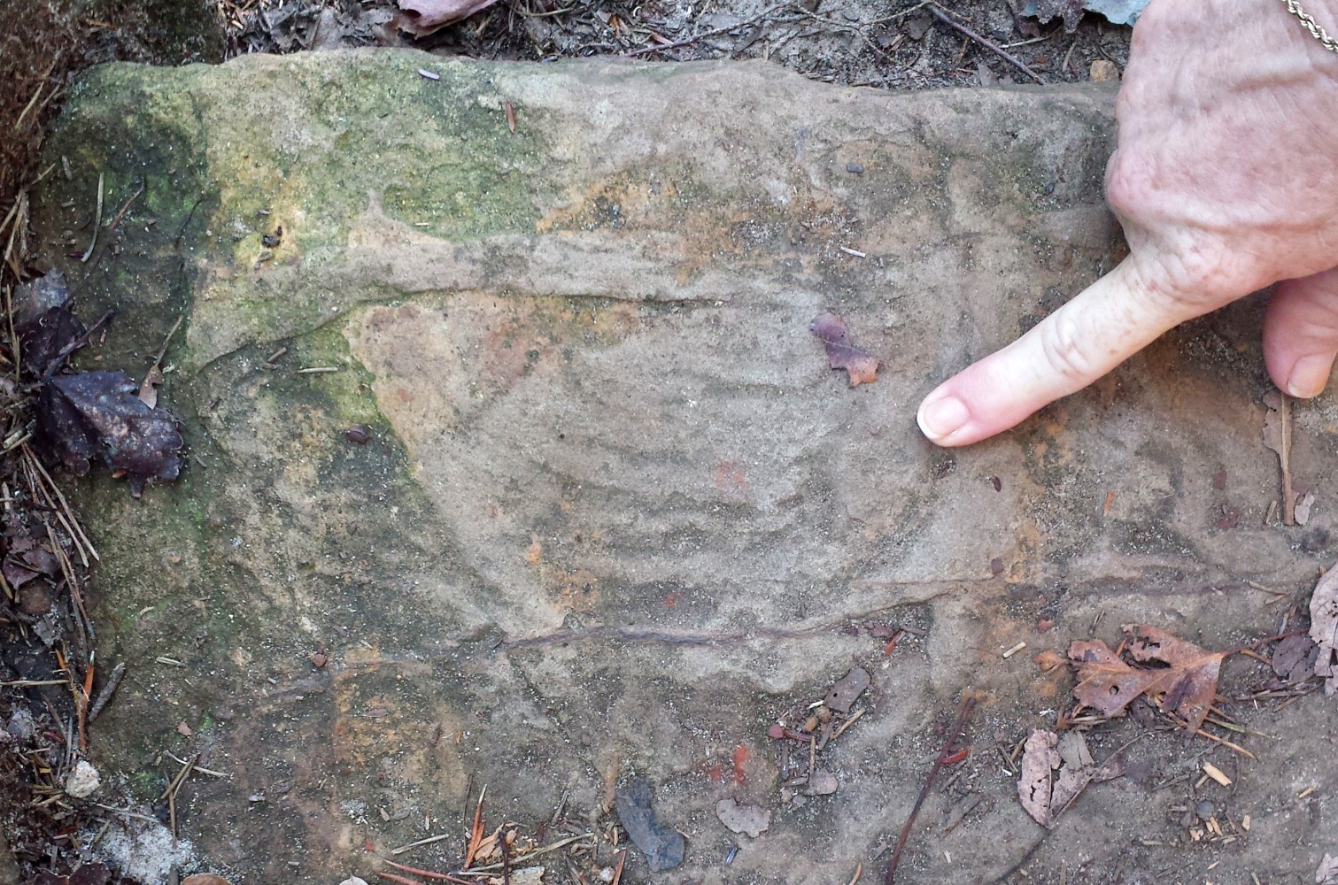

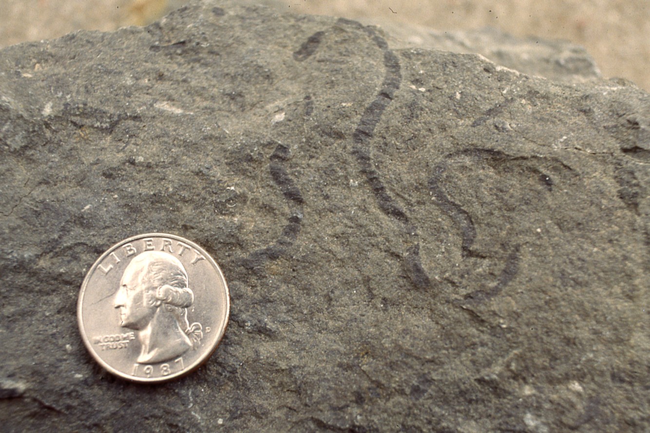

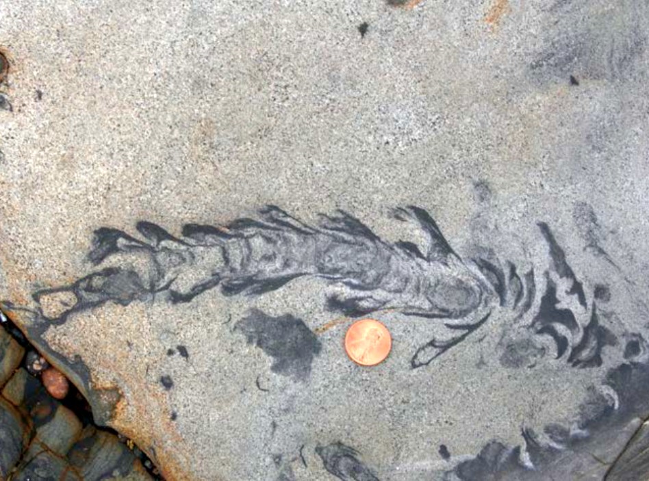


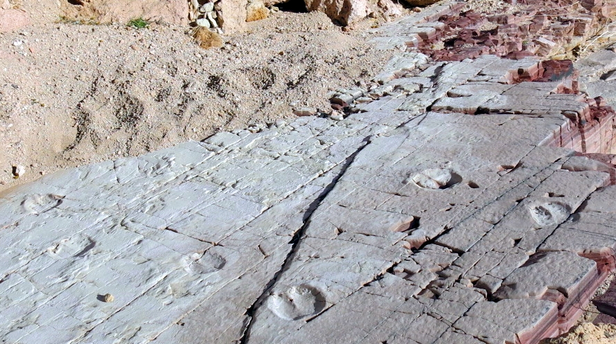


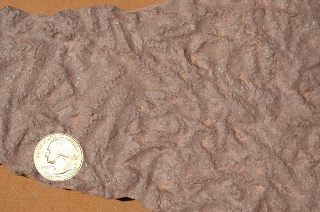
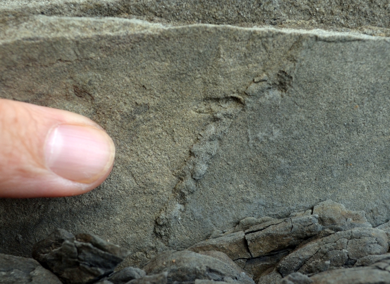

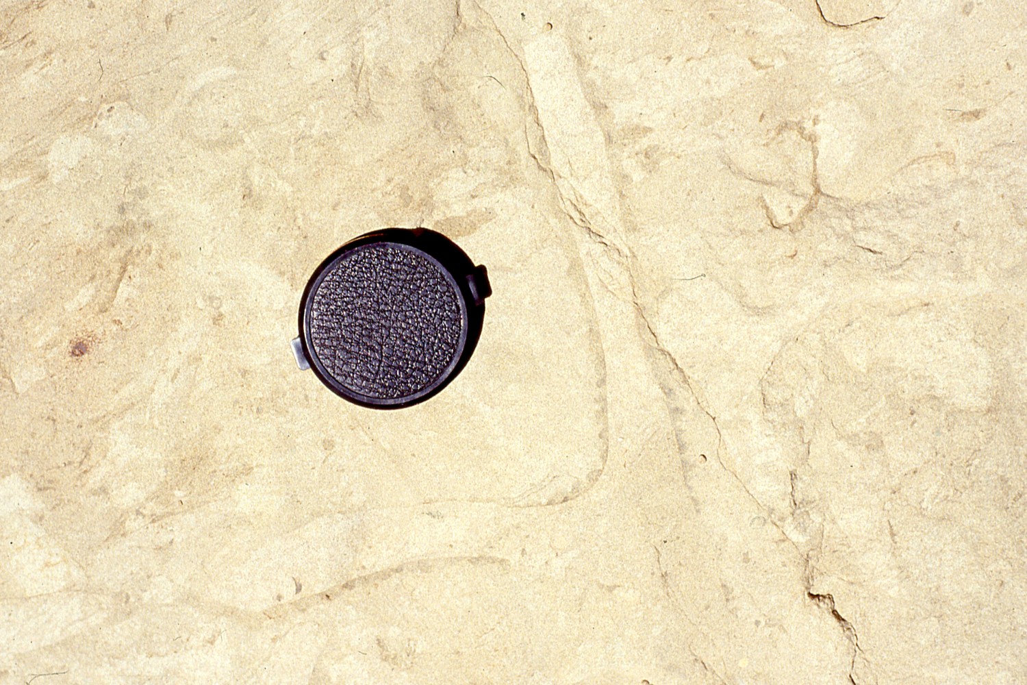
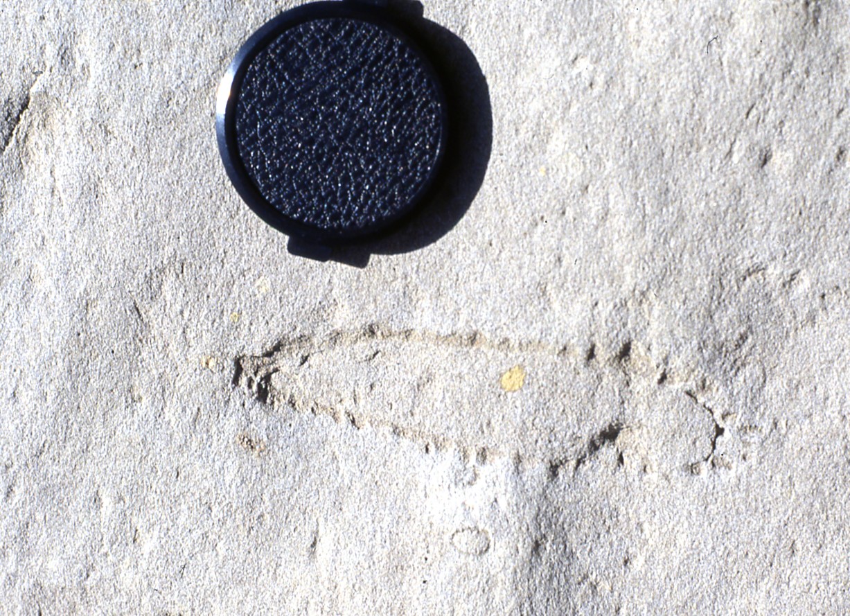
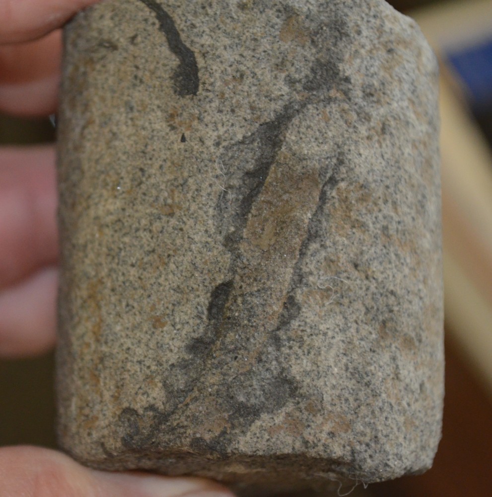

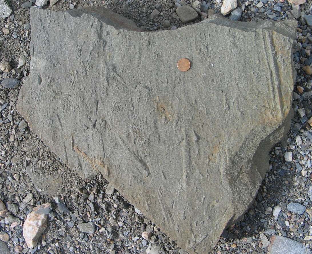
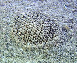


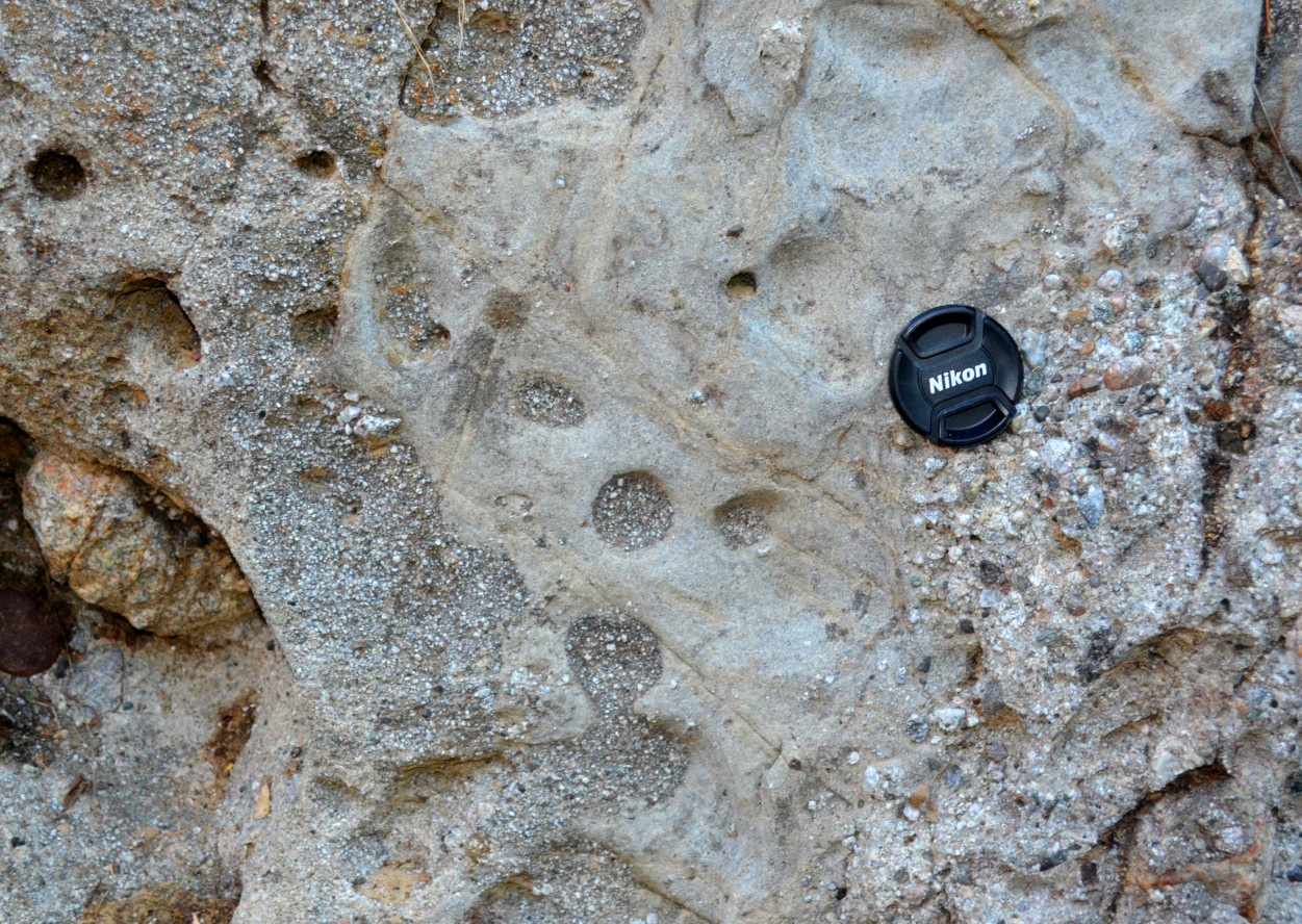
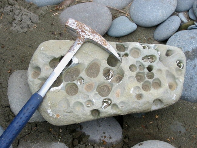
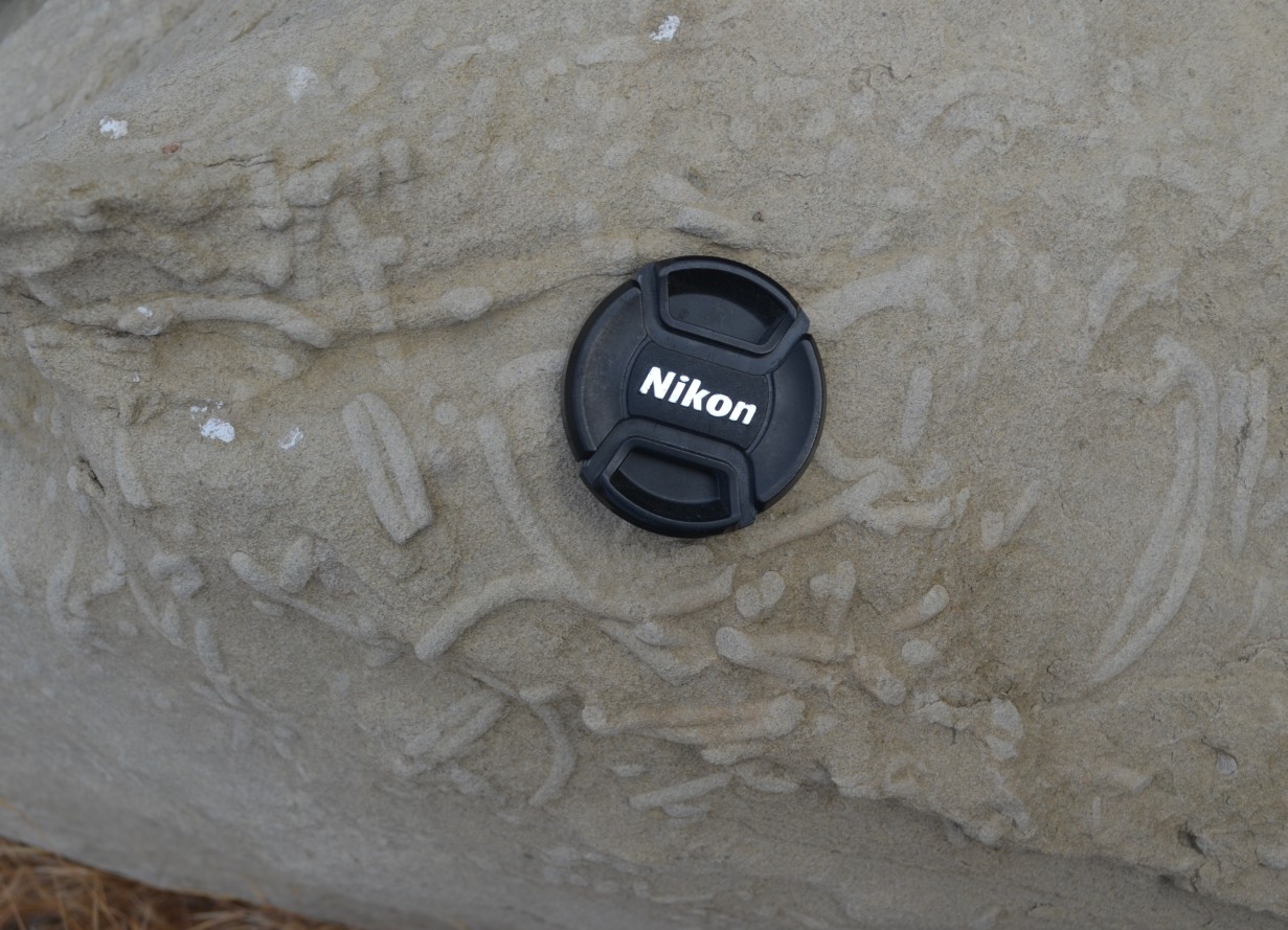
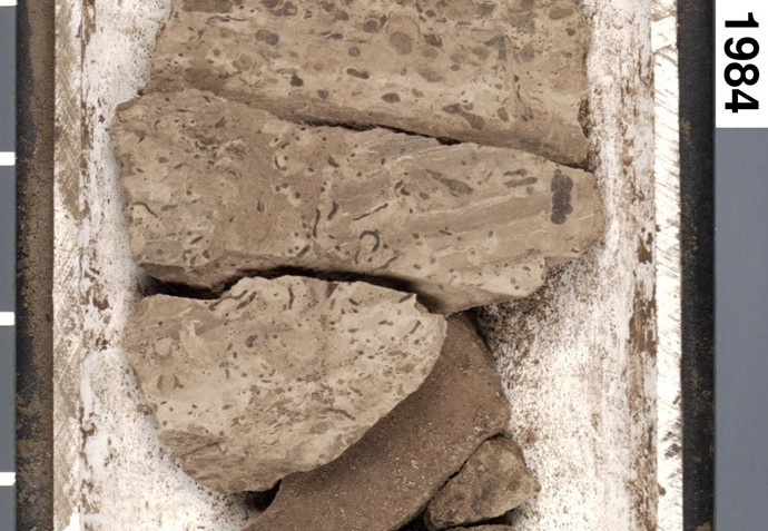
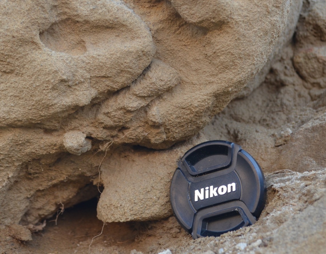
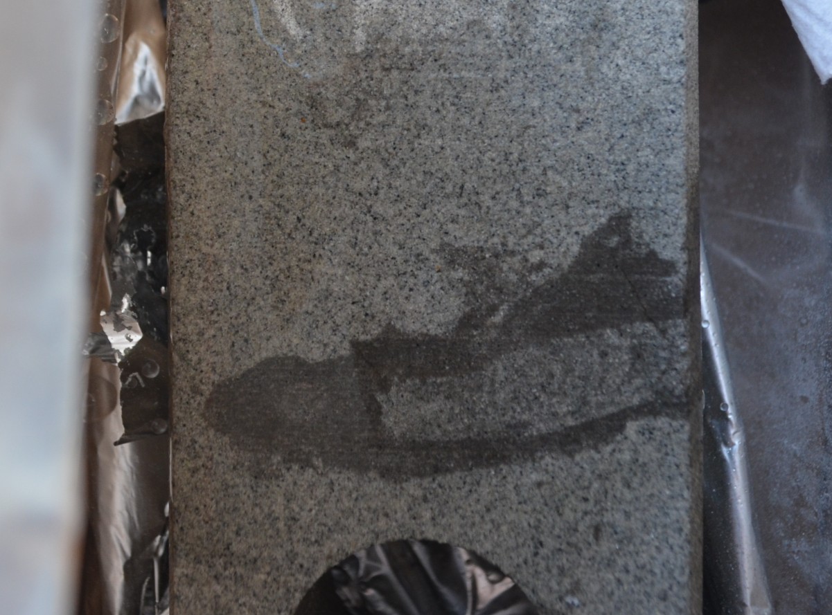

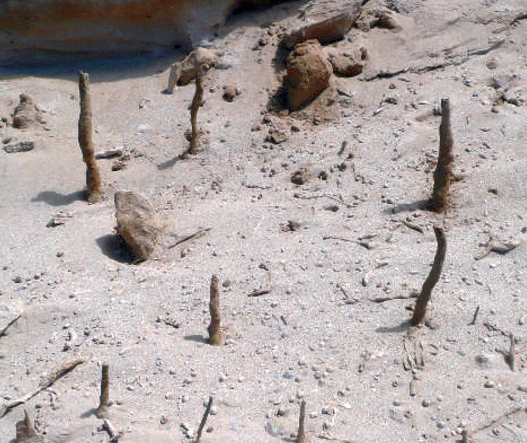

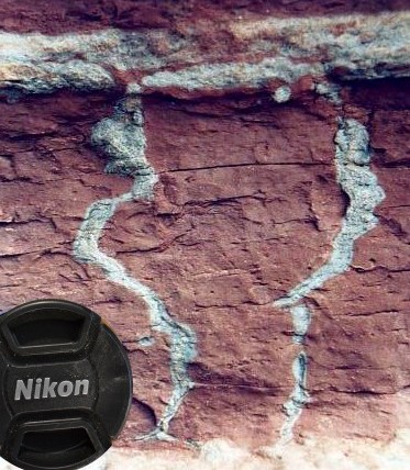
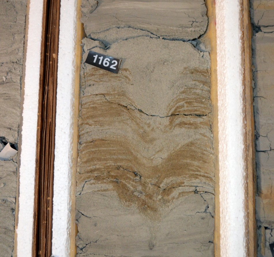
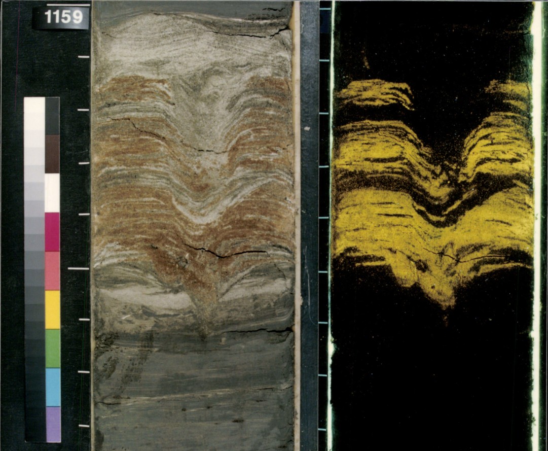

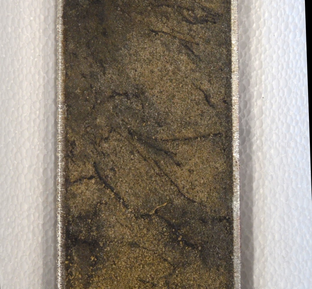
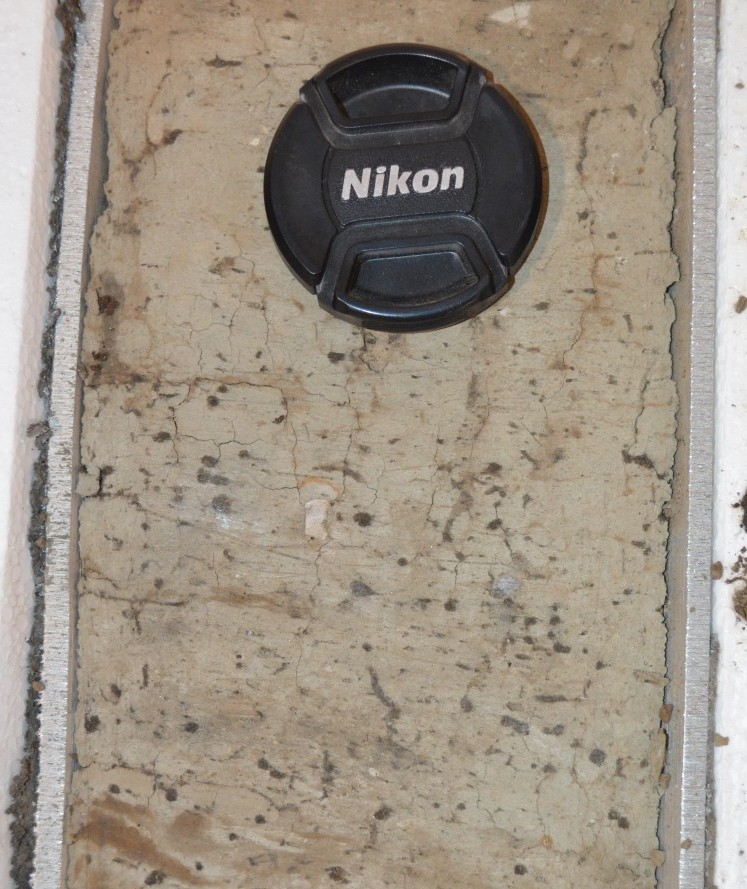
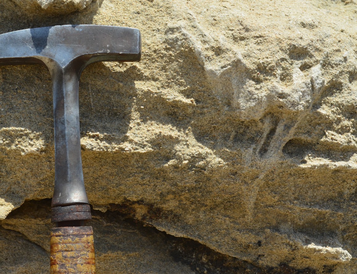
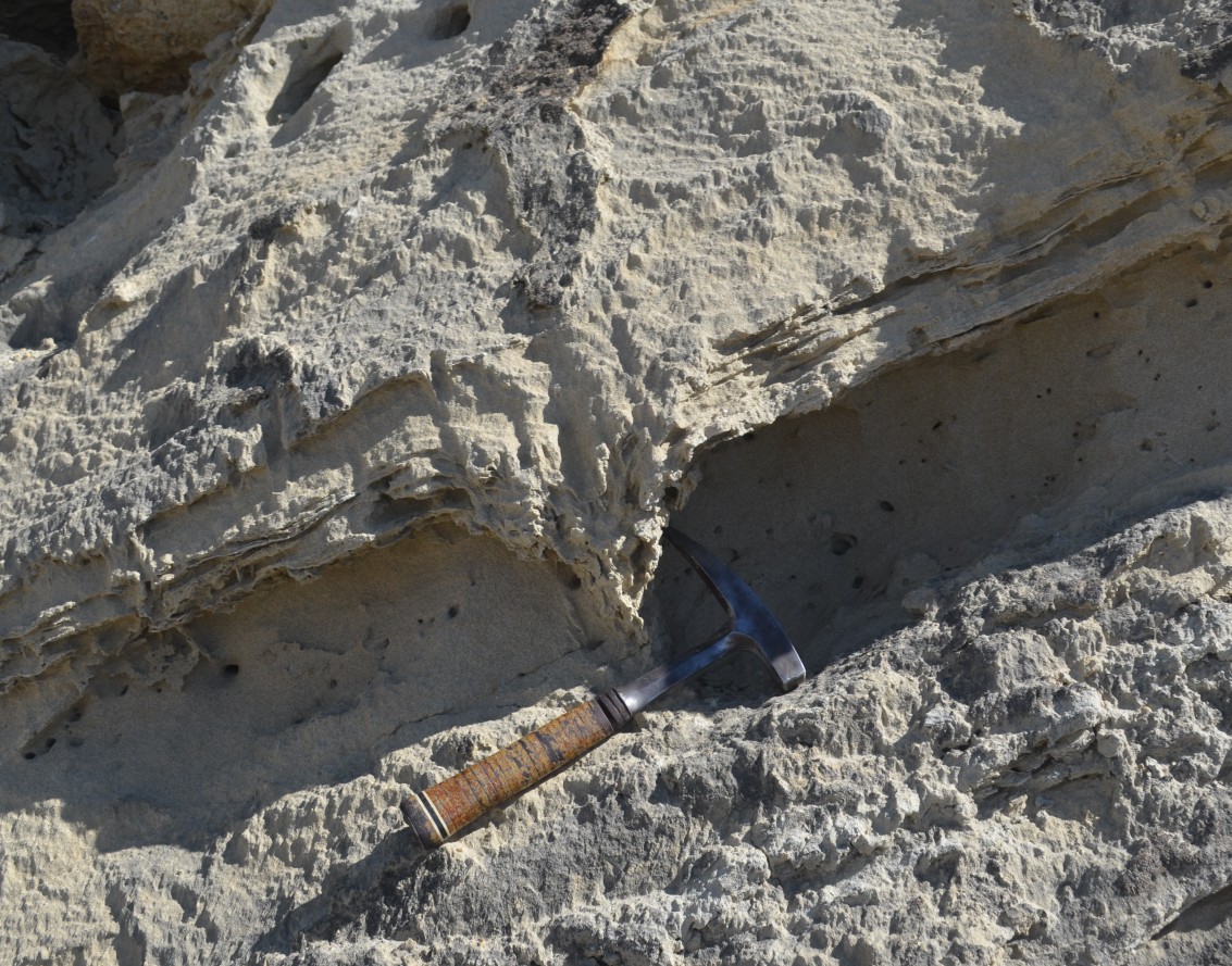


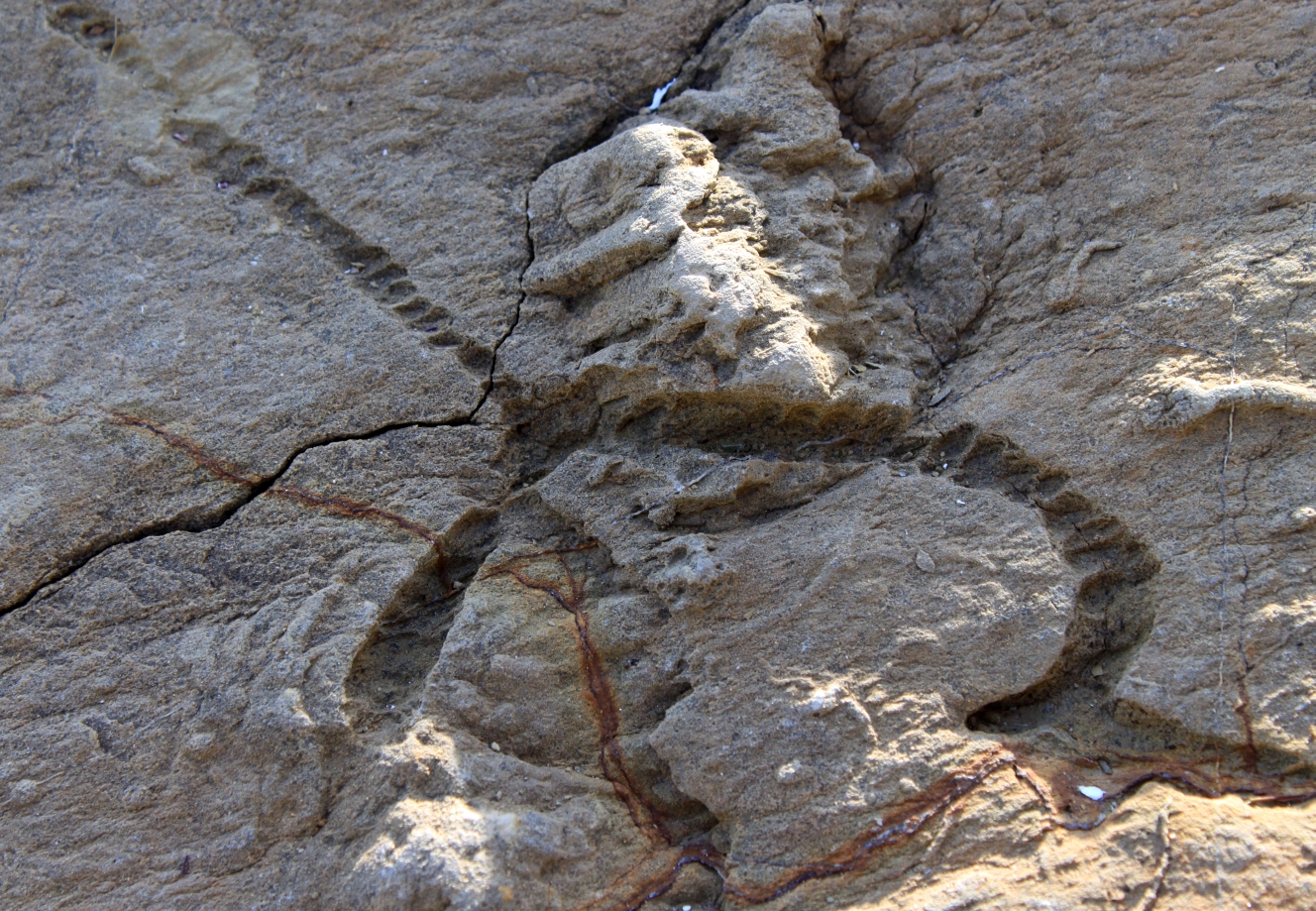

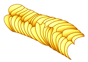


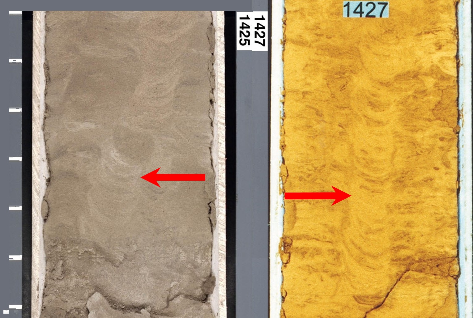

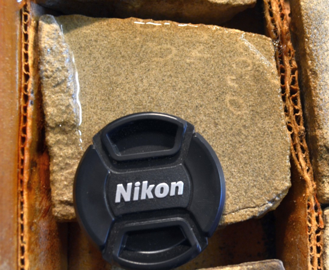
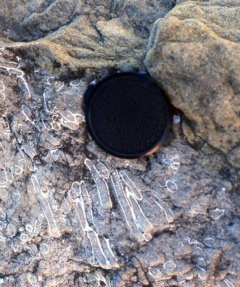

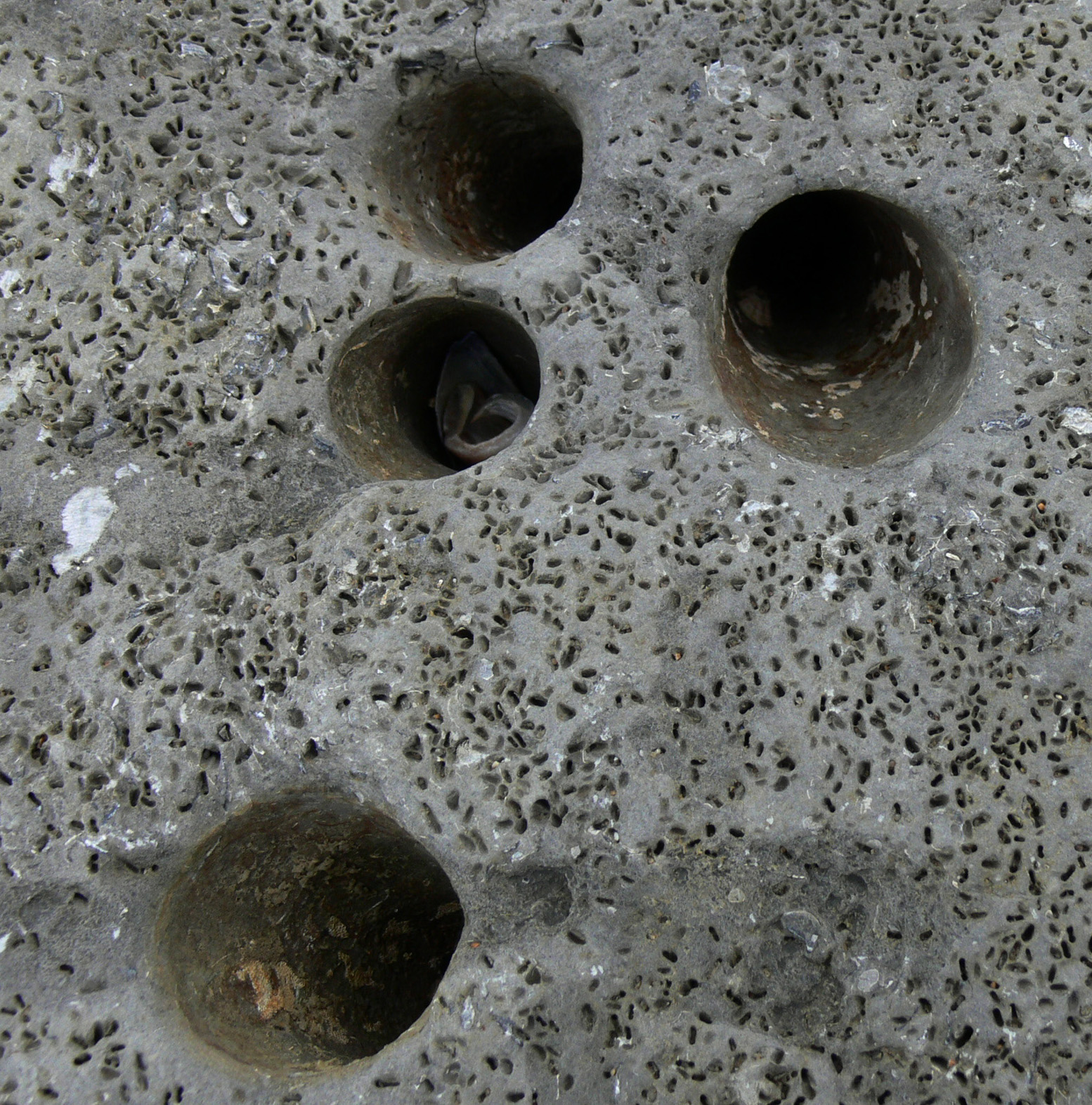
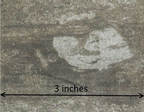

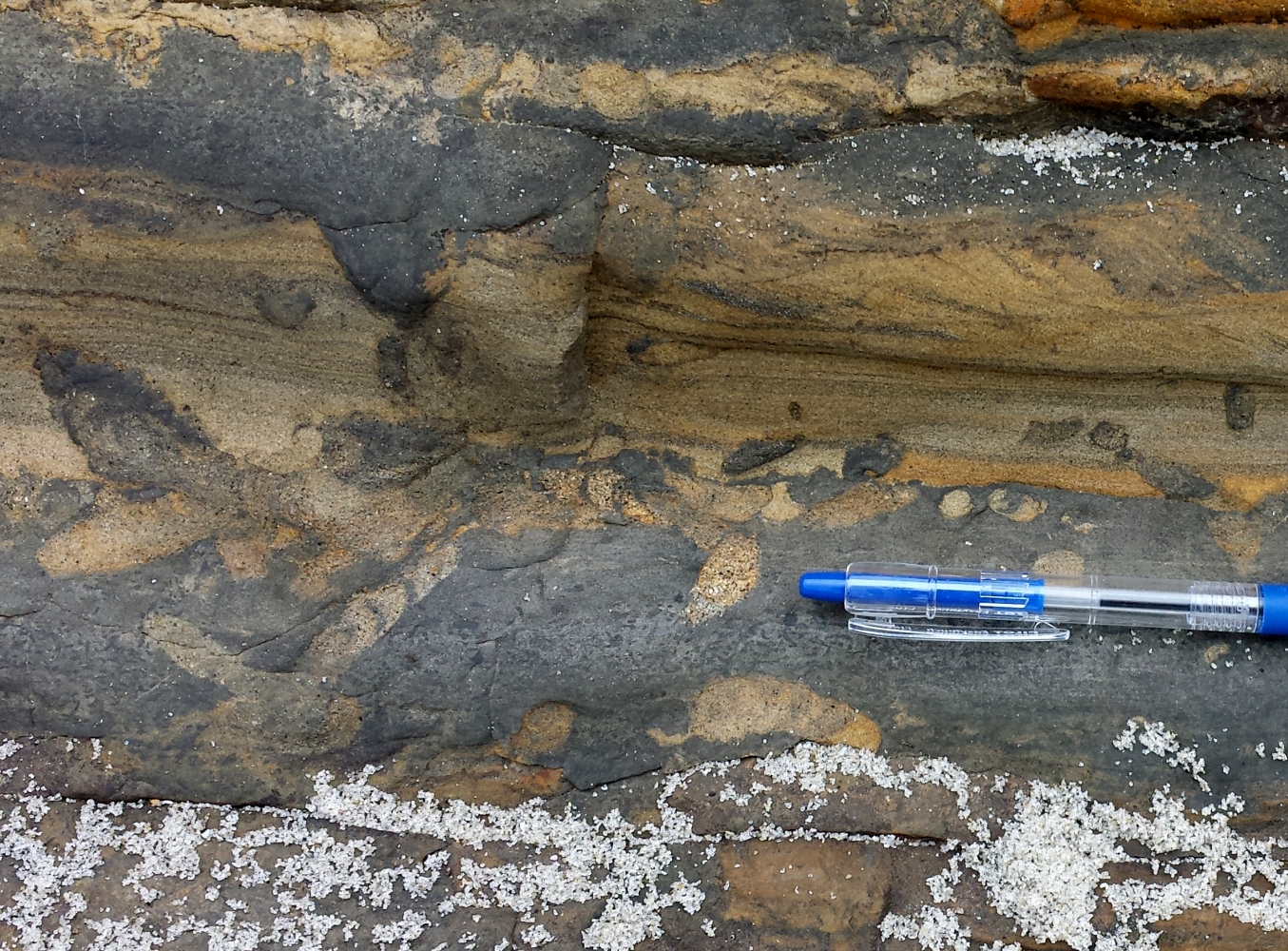


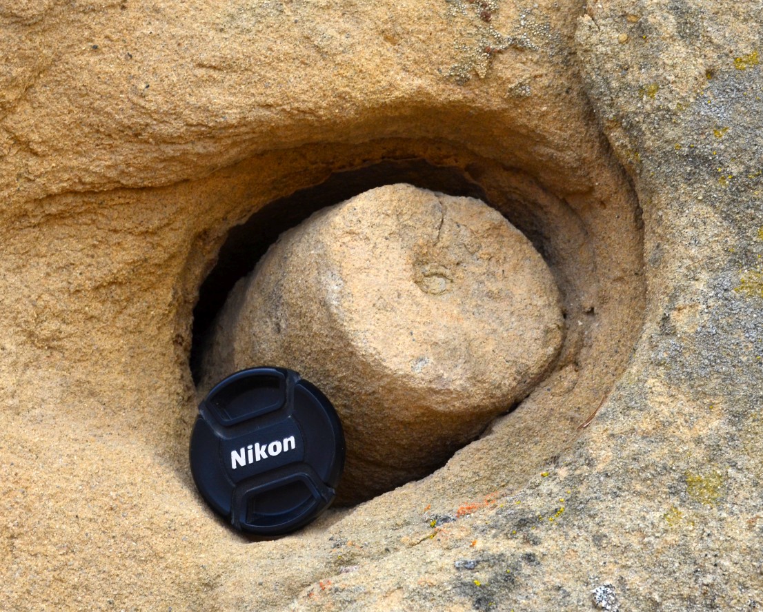
 Armored Mud Balls - Because of their concentric appearance, these structures, along with weathering rinds, might be confused with rhizocretions (a type of root trace). Armored mud balls form in both fluvial (more common) and marine settings (less common) when a ball of mud gets rolled around on a beach, and acquires a coating of sand grains. Though less common, they may also form when sedimentary clasts are rolled around on a bank of mud to acquire a clay coating. Similar, but rare, structures found in turbidites are elongate, spindle-shaped features that form at the base of sediment gravity flows, with the direction of transport being perpendicular to the long axis of the spindle. These "spindles" generally have cores of mud, and an outer coating of sand, indicating that mud was rolled along at the base of the flow, with sand grains sticking to the mud to form a coating.


 Dish Structures - As the sand suspended in a turbidity current starts to settle out, insipient clay laminations may begin to form concurrent with the upward movement of water that has been forced out from between the settling grains. Dewatering pipes within the sand may then form and distort these clay laminations to form concave-up patterns that resemble small dishes, with an overall pattern that may be confused by some as bioturbation. Some nice dish structures are shown on the left in the Point of Rocks sandstone at Salt Creek in the Temblor Range (west margin of the San Joaquin Valley). Though very faint and hard to see, there are dish structures in the two cores shown on the right - both from the 36X-14 well in the Middle Miocene Nozu Sandstone (Monterey Formation) at Stockdale Ranch oil field (San Joaquin Valley).

 Flute Casts - These are found on the underside of turbidite sandstone beds, generally on the underside of the Bouma B interval of parallel laminations. They result from small eddies in a turbulent flow, in which the eddies start to excavate a circular scour in the sediment below, but then dissipate and taper off in the downstream direction. Flute casts conceivably could be confused with the resting traces of an organism. The outcrop example shown on the left is from the Eocene Point of Rocks sandstone exposed at Salt Creek in the Temblor Range on the west margin of the San Joaquin Valley, and it shows the paleocurrent direction going from right to left. On the right is a flute cast in a core of the Miocene Carneros Formation from the 50X-27 well at South Belridge oil field (San Joaquin Valley). It shows the current direction going from right to left.
 Groove Casts (Drag Casts) - When turbidity currents are transporting sediment, they may drag rocks and shells along at the base of the flow and cut long grooves into the muddy sediment beneath. As sand carried by the current settles out and fills the groove, a groove cast will be formed. These are typically found on the underside of the Bouma B interval of parallel laminations of a turbidite sandstone. Groove casts may resemble, and conceivably could be confused with grazing traces, such as Nereites and Neonereites that are exposed at the base of a turbidite bed. However, most groove casts are straight as a ruler and have a smooth profile, whereas grazing traces typically meander around and have fecal pellets associated with them.
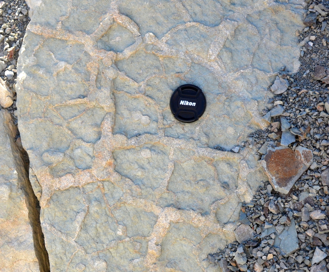
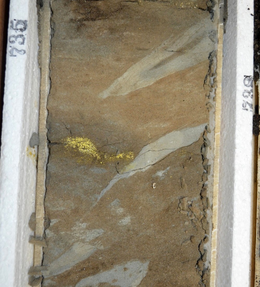 Mudcracks - Dessication (shinkage) cracks may form in non-marine mudstones as they dry out in the sun, and are subsequently filled in by sediment. Mudcracks cut across bedding in cross-section view, and form polygonal patterns in map view. Multiple episodes of dessication, with later infilling and re-wetting may be displayed. Although mudcracks in many cases display regular polygonal shapes, they conceivably could be confused with Thalassinoides burrows. Sub-aqueous shinkage cracks known as syneresis cracks are similar to mudracks, but form in limey sediments during contraction of clays in the rock response to salinity changes in an overlying water column. However, syneresis cracks tend be much more discontinous and irregular than most mudcracks.
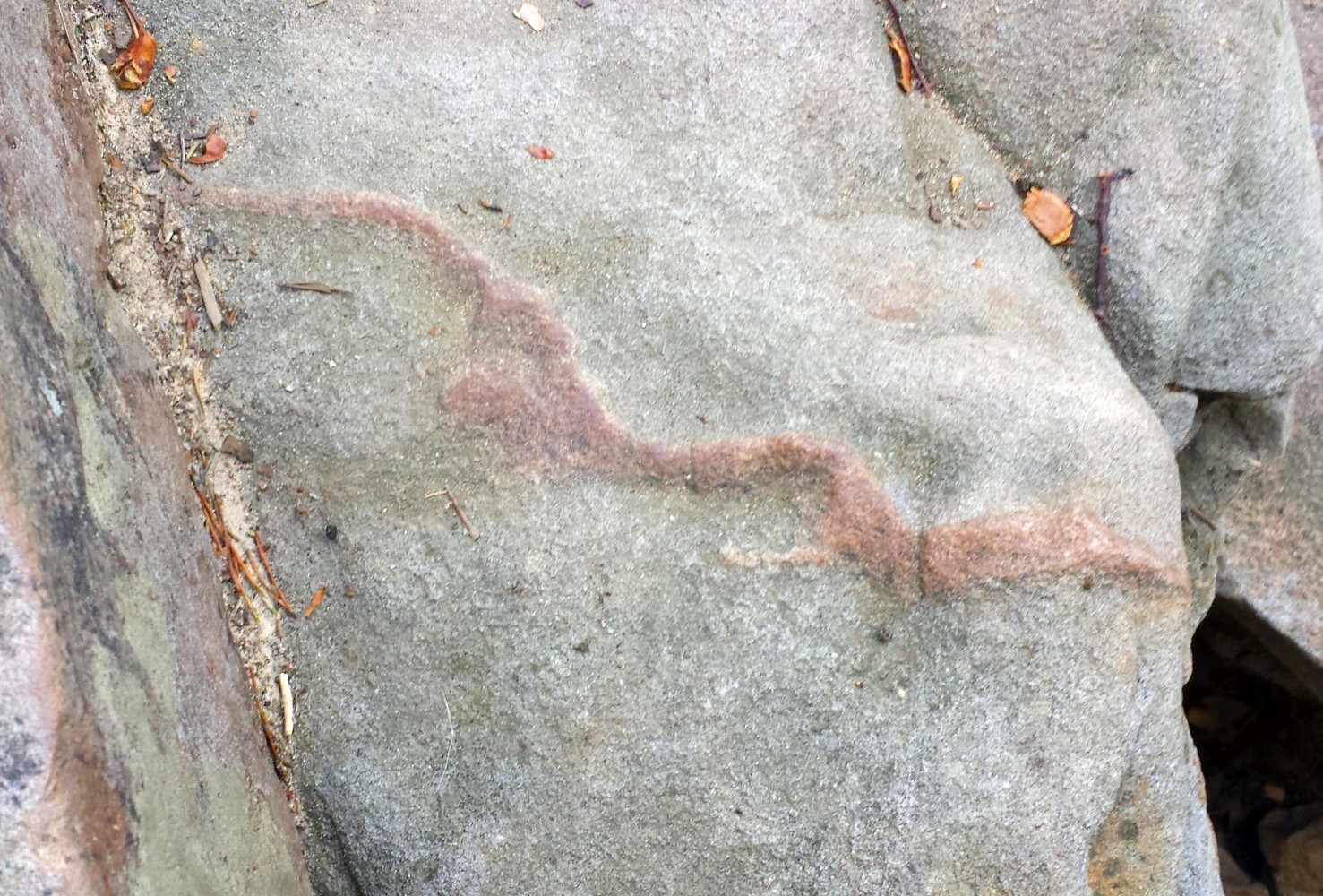
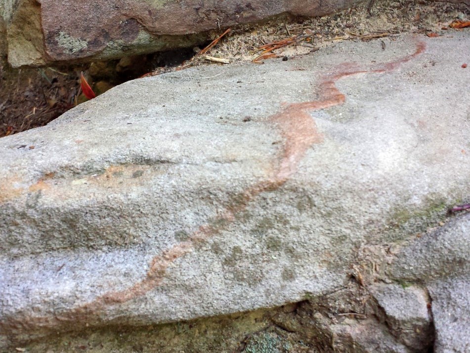
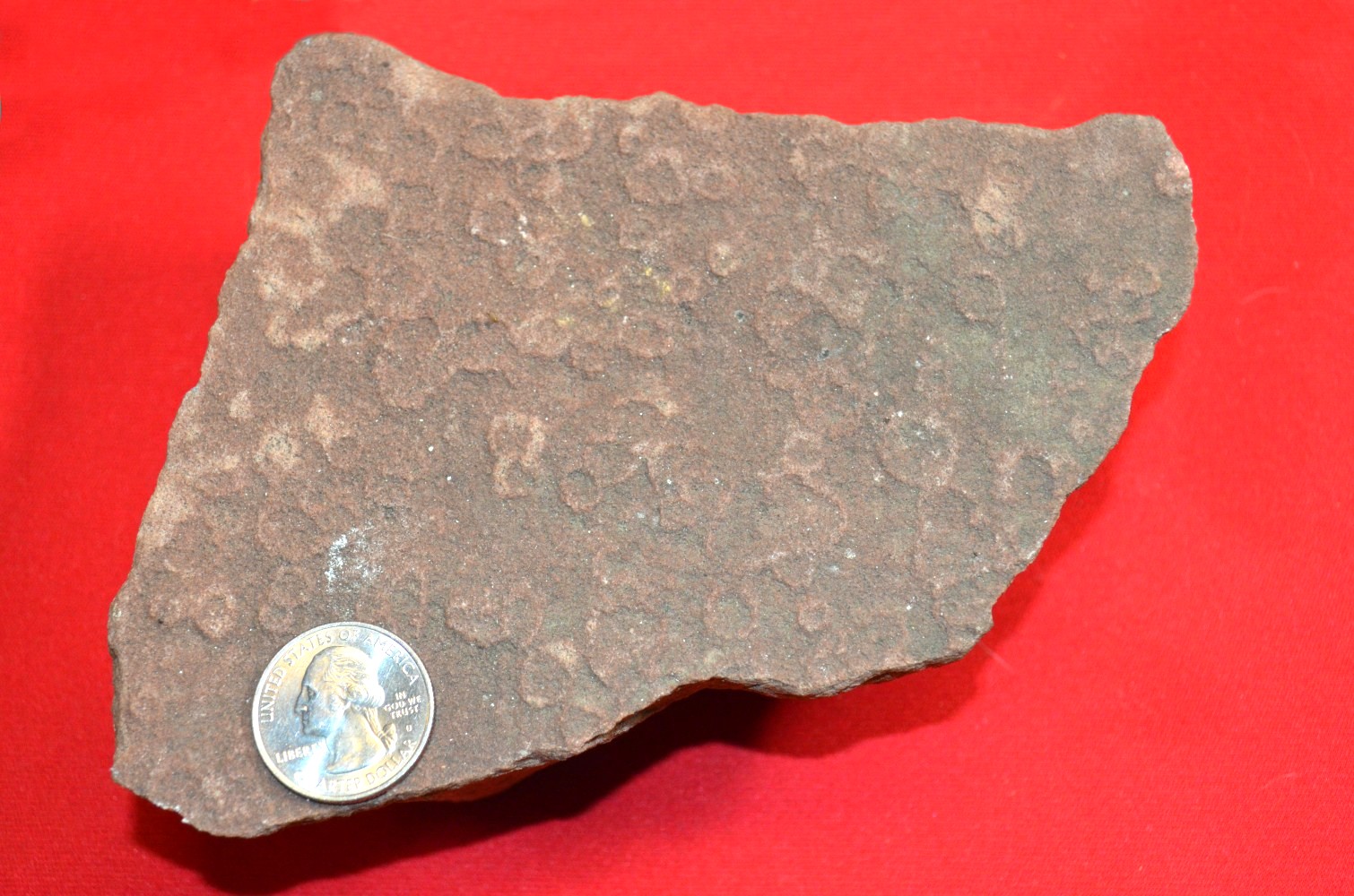

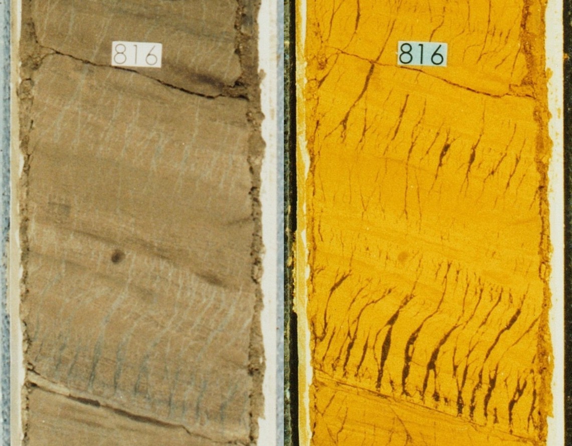 Tiger-stripe Diatomites - This interesting structure closely resembles molar tooth structure, which is a texture found in certain Cambrian, fine-grained carbonates, and is so called because it resembles the fossil teeth of ancient Mammoths. However, the so-called "tiger-stripes" shown here are sinusoidal-shaped concentrations of clay and diatomite that are finer grained than the surrounding matrix. A number of interpretions have been proposed, including syneresis cracks, and tension fractures resulting from downslope movement during earthquakes. However, both of these interpretations require filling of an open fracture, for which there does not seem to be evidence. The most reasonable interpretation is that these stripes are Intrastratal Microfractured Zones (IMZs) that represent zones of shear that developed during downslope movement and shaking of a water-charged diatomite, probably during earthquakes. Fine-grained particles within the diatomite migrate into the shear zones as they develop, and the zones are deformed into the s-shaped geometries that characterize the tiger stripes. The outcrop example shown on the left is from the lower Antelope Shale exposed along Chico-Martinez Creek in the Temblor Range on the west margin of the San Joaquin Valley. The photo on the right shows IMZs in a core of the Upper Miocene Marvic (Stevens) Sandstone from the Dickinson Trust 1-168 well at North Midway oil field (San Joaquin Valley).


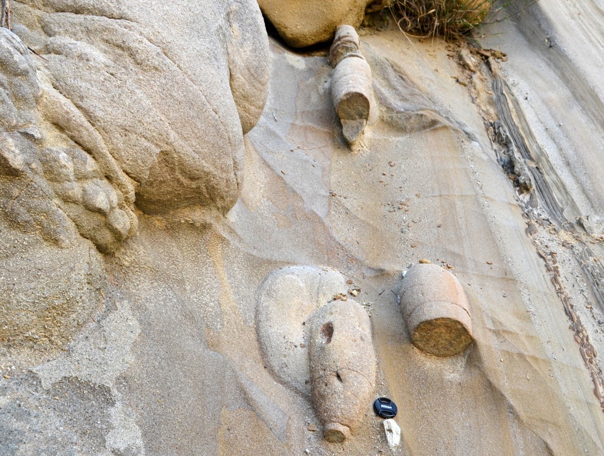
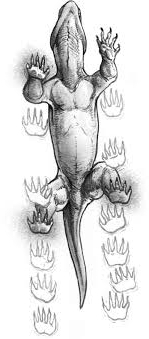