Introduction to the
Geology of the San Joaquin Valley
There are several aspects to the geology of the San Joaquin Valley. The story begins here with the Geologic History. Links to the other chapters of this story are on the menu to the left.
Geologic History
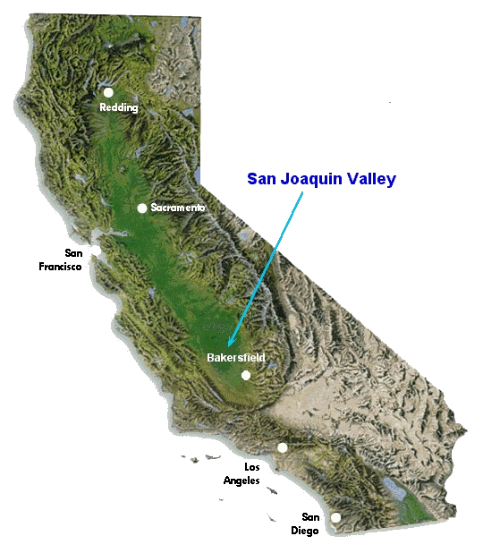 The San Joaquin Valley is a sediment-filled depression, called a basin, that is bound to the west by the California Coast Ranges, and to the east by the Sierra Nevadas. It is classified as a forearc basin, which basically means that it is a basin that formed in front of a mountain range. The San Joaquin Valley is a sediment-filled depression, called a basin, that is bound to the west by the California Coast Ranges, and to the east by the Sierra Nevadas. It is classified as a forearc basin, which basically means that it is a basin that formed in front of a mountain range.
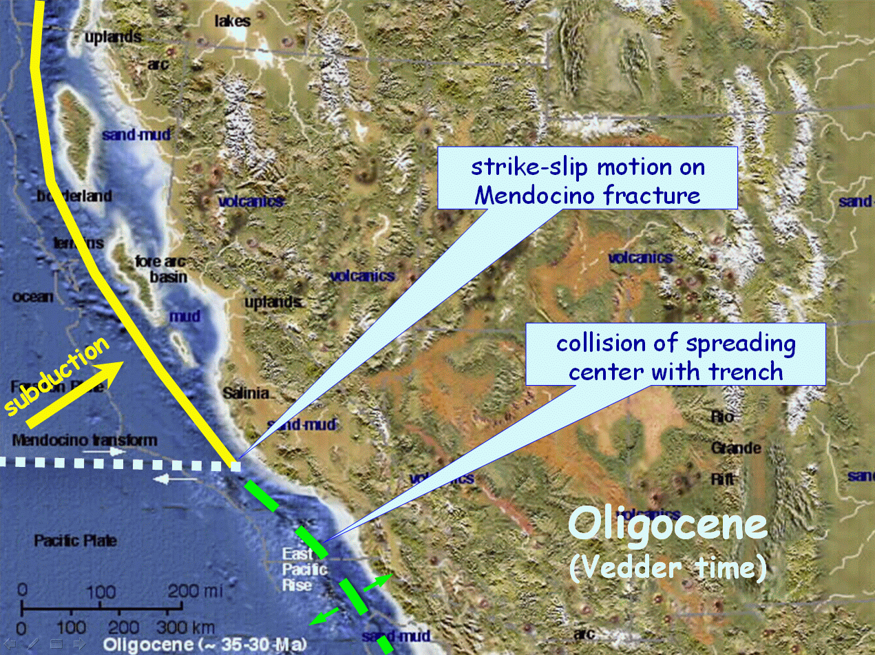
The Valley dates back more than 65 million years ago to the Mesozoic, when subduction was taking place off the coast of California. However, the plate tectonic configuration of western North America changed during the Tertiary, and the ancient trench that once characterized offshore California was transformed into a zone of right-lateral strike-slip motion that we know today as the San Andreas fault. Nonetheless, the Valley still retains many features that characterized it prior to formation of the San Andreas transform.
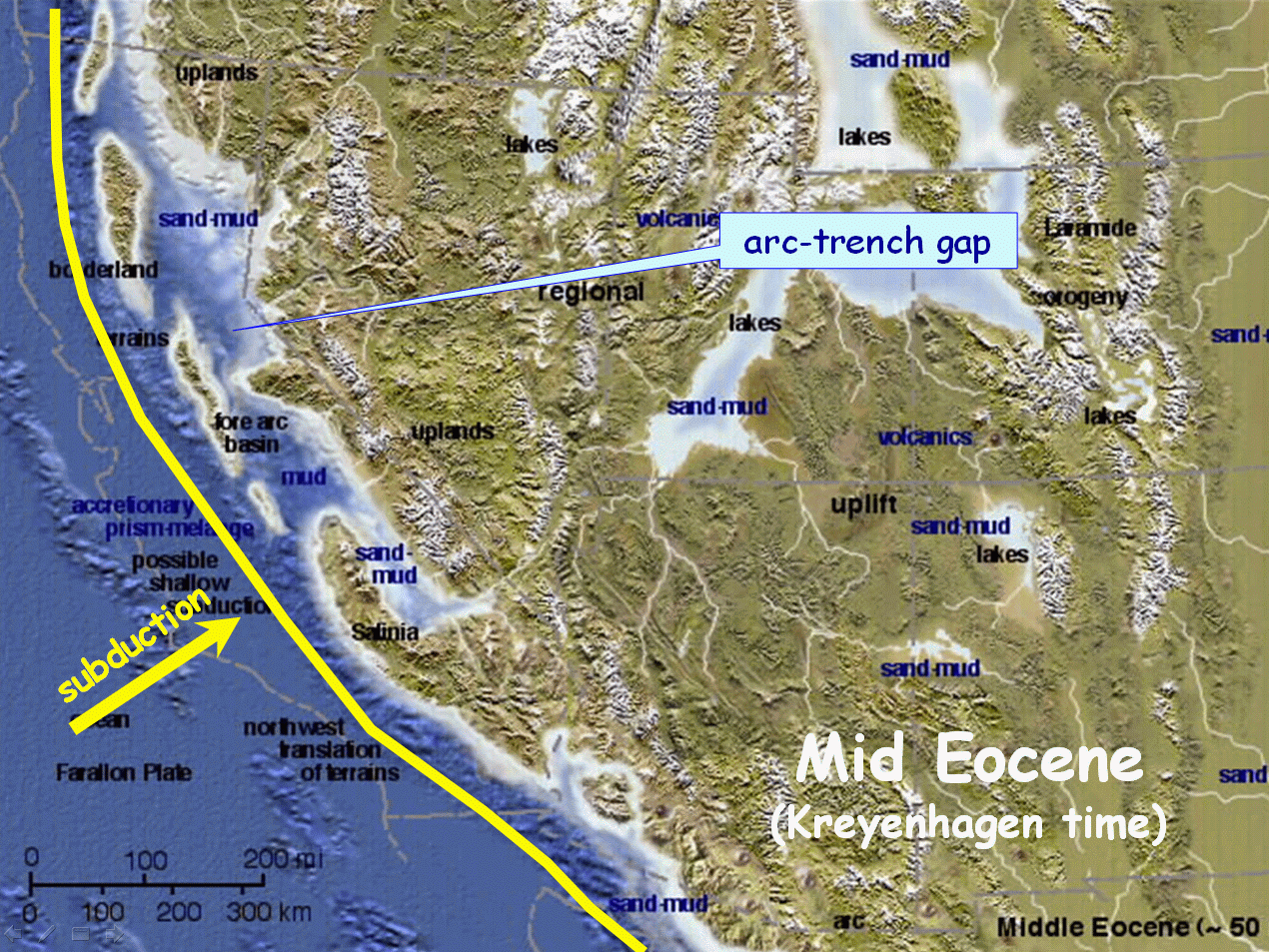
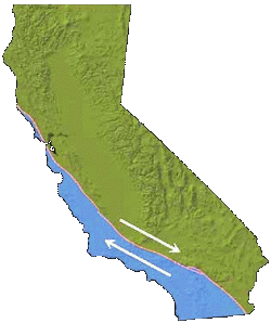 Because the San Joaquin Valley is bound to the west by the California Coast Ranges, which represent a zone of folding and thrusting (i.e., an accretionary prism) associated with the ancient subduction zone, and bound to the east by the Sierra Nevadas, which represent the eroded roots of an ancient volcanic arc that was also associated with the subduction zone, some call the valley a remnant arc-trench gap. Because the San Joaquin Valley is bound to the west by the California Coast Ranges, which represent a zone of folding and thrusting (i.e., an accretionary prism) associated with the ancient subduction zone, and bound to the east by the Sierra Nevadas, which represent the eroded roots of an ancient volcanic arc that was also associated with the subduction zone, some call the valley a remnant arc-trench gap.
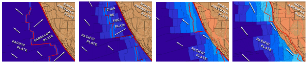
The tectonic processes by which this arc-trench gap formed are complicated, as are the events by which the ancient trench became the San Andreas fault. These events are covered in more detail in the plate tectonics section of this website, and the four panels below show a snapshot of the key events.
When the San Joaquin Valley first formed it was an inland sea between two mountain ranges. This configuration remained even after formation of the San Andreas fault (below). However, as the volcanic cover of the Sierras was eroded off, the resulting sediment was dumped into the Valley below. At the same time, The Coast Ranges were also being worn down and dumped into the valley. Thus, the inland sea was filled to create the continental basin we know today.
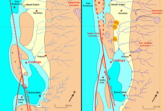
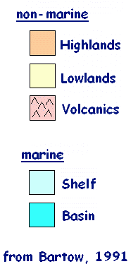 The maps above show the San Joaquin basin during the middle Miocene (left) and the late Miocene (right) when the principle source rocks were deposited. From these source rocks most of the oil in the valley is derived. The maps above show the San Joaquin basin during the middle Miocene (left) and the late Miocene (right) when the principle source rocks were deposited. From these source rocks most of the oil in the valley is derived.
When the basin was still an inland sea, diatoms and other plankton thrived in it, and when these organisms died they accumulated on the basin floor to create organic-rich shales that include the Eocene Kreyenhagen, and Miocene Monterey Formations. The integrated effects of heat and time then acted on the buried organic matter within these shales to create oil, and the detritus eroded from the Coast Ranges and the Sierra Nevadas provided reservoir rocks where the oil could accumulate.
Paleogeography
Four maps of the paleogeography of the San Joaquin Valley over geologic time are shown below. Clicking on any map will show a more detailed version.
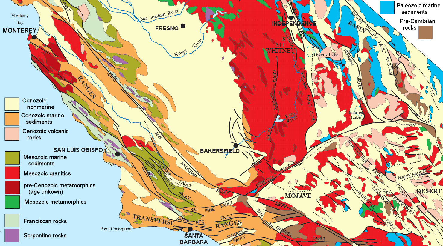
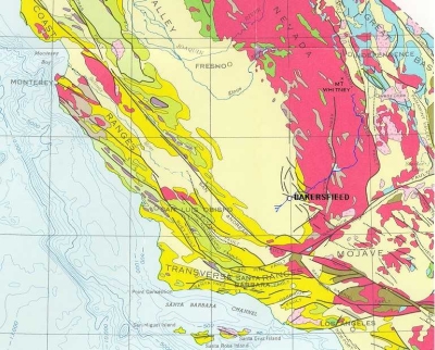
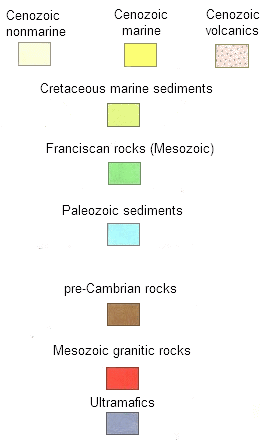
Geologic Map of the San Joaquin Valley
click on the map to view a more detailed version
|