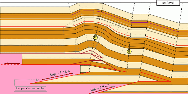
From Chris A. Guzofski & John H. Shaw (2007)
Shown below is the detailed geology of the Coalinga area, and the epicenters of the
(1) 1982 New Idria, (2) 1983 Coalinga, and (3) 1985 Kettleman Hills earthquakes.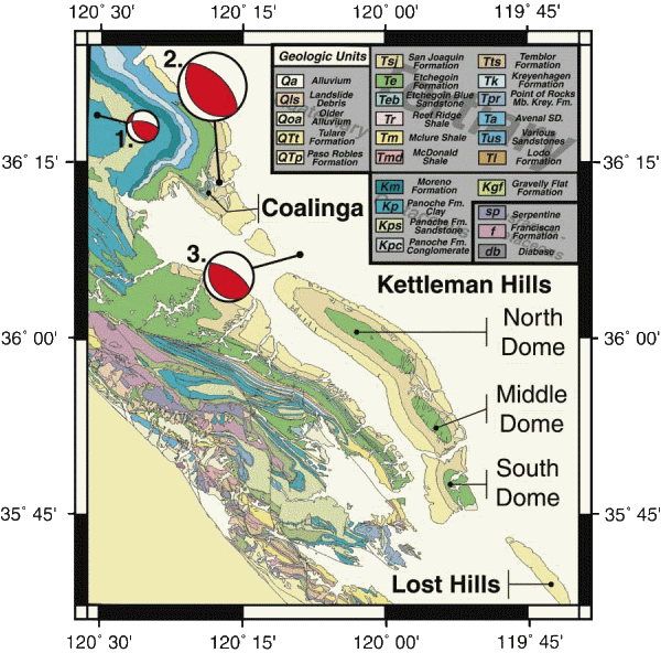
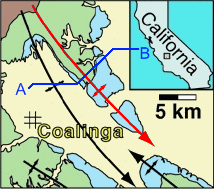
This simplified geologic map shows the
location of the sections that follow
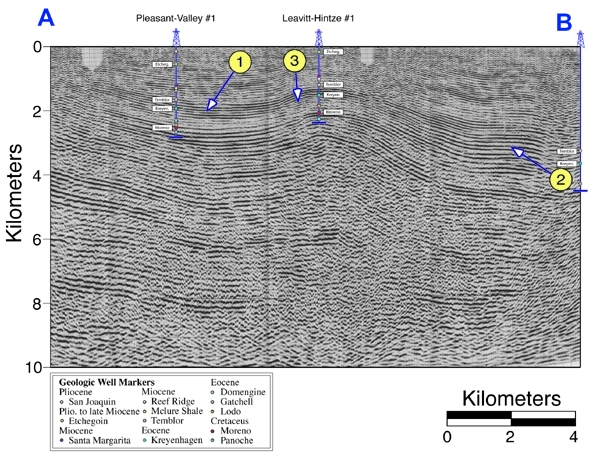
Uninterpreted seismic line A-B.
Interpreted seismic line A-B showing the focus
of the 1983 quake along a blind thrust that cuts basement.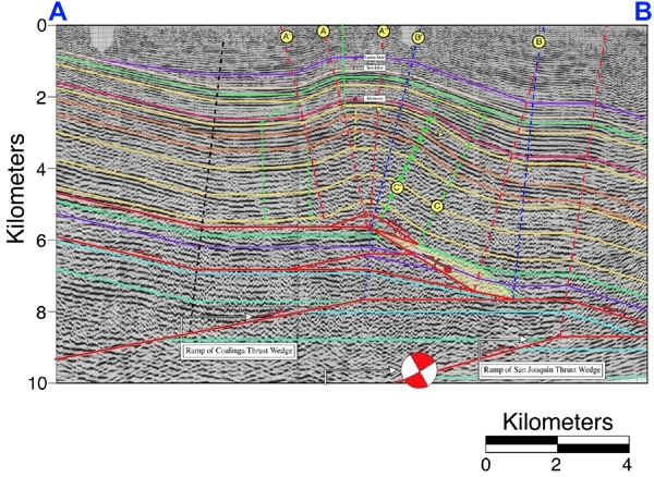
A balanced cross-section interpreted from seismic line A-B.